Author: Rach (10,11,13 March) & Ged (12 & 14 March)
Photos: Rach (unless specified otherwise)
Our second week in New Zealand would give us the full sights, smells and sounds of the North Island – we’re starting to pick up the lingo, so this week really was “sweet as, Bro!”
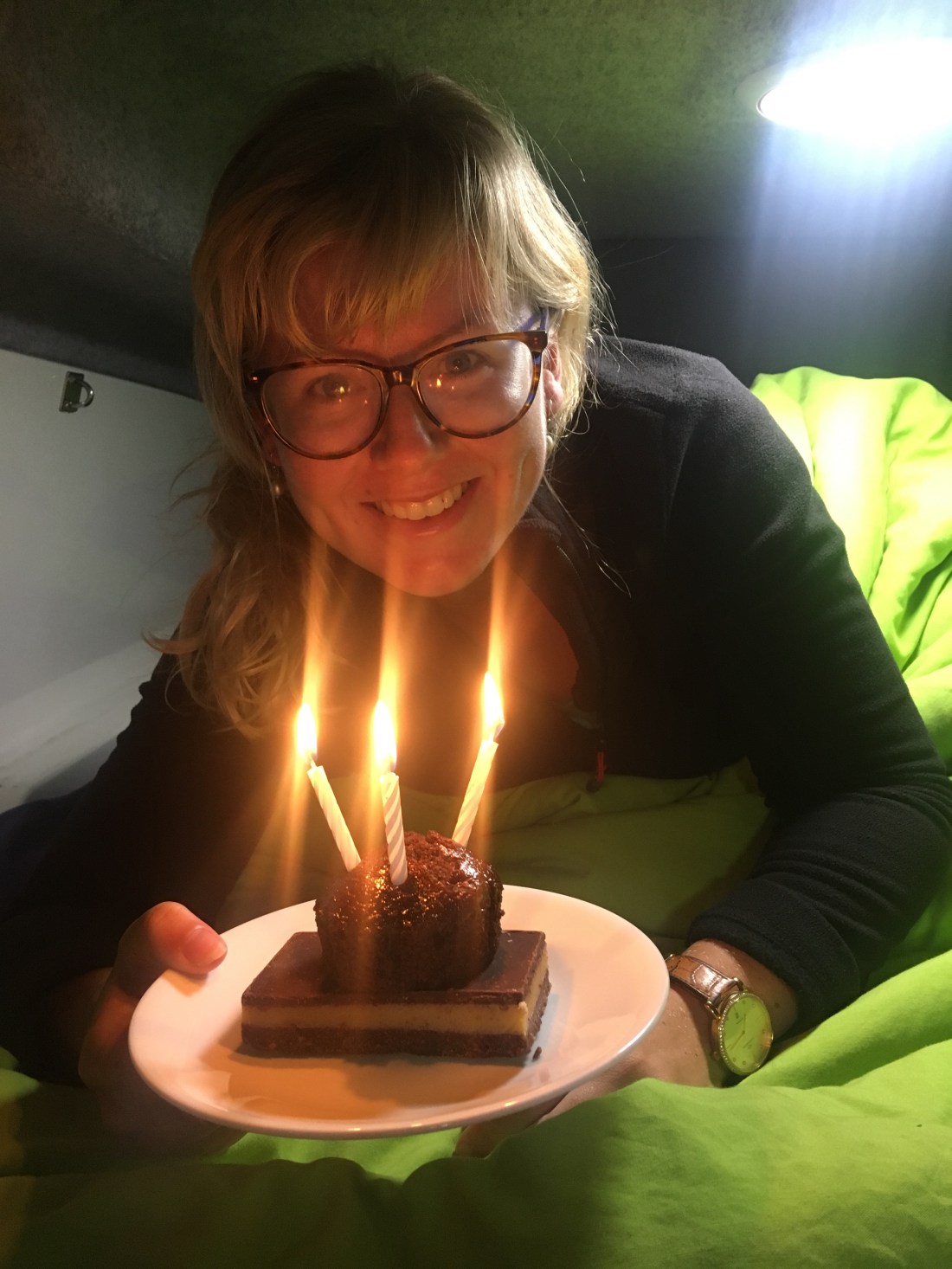
10 March – birthday girl!
I woke up on my birthday fresh from a campsite shower and surrounded by our first clean wash drying on our makeshift washing lines in the van. A more unusual way to start a birthday! I was treated at 7am to a bacon butty and a two-tiered millionaire’s shortbread and chocolate cupcake with candles from Ged. Another year older!
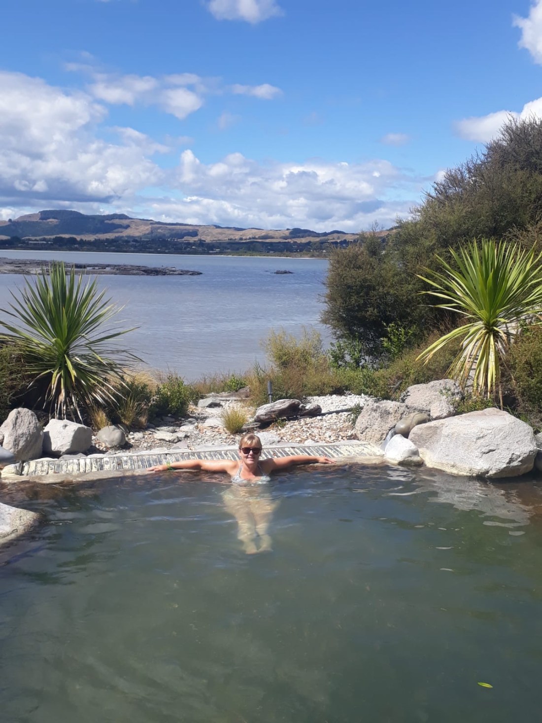
Today would be a treat – a little luxury for the first time in months via a thermal spa and massage (thanks family & friends for the birthday money!) First up though, some mandatory birthday views!
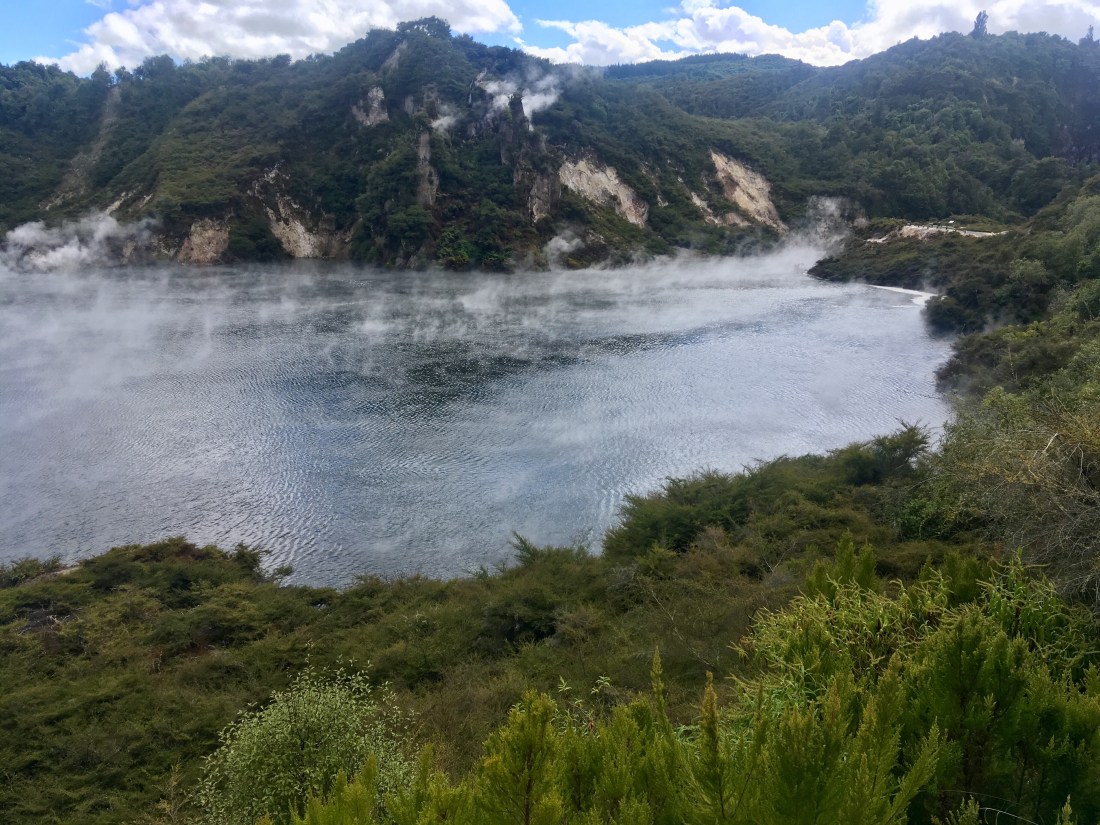
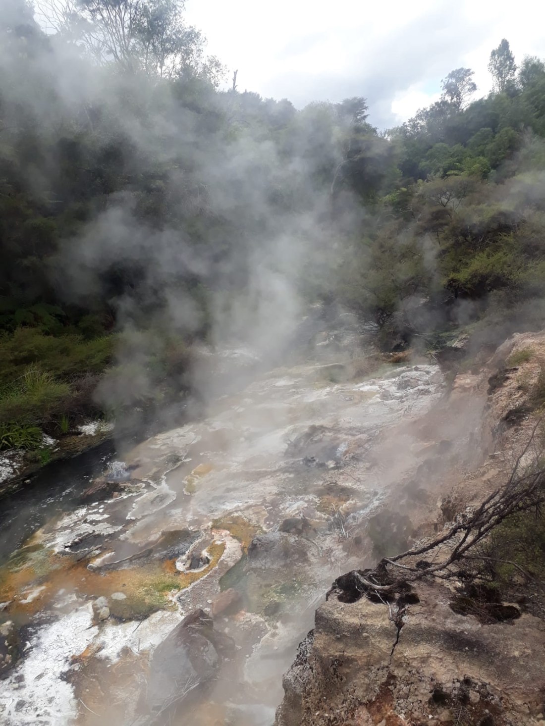
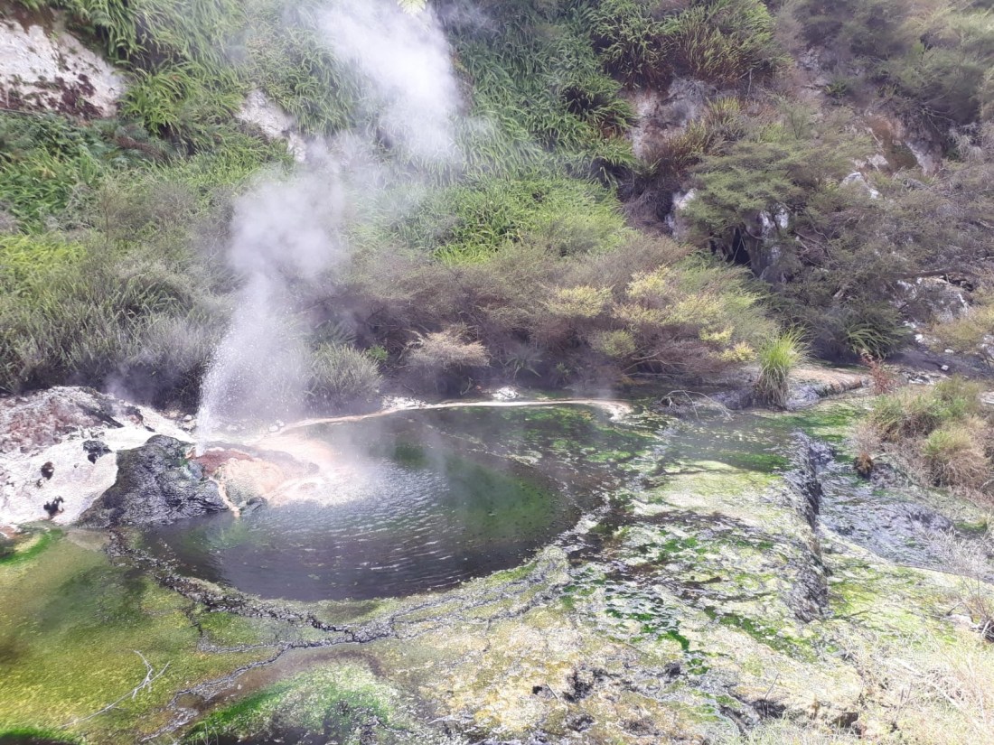
We spent the morning visiting the Waimangu volcanic valley, in the Rotorua region.
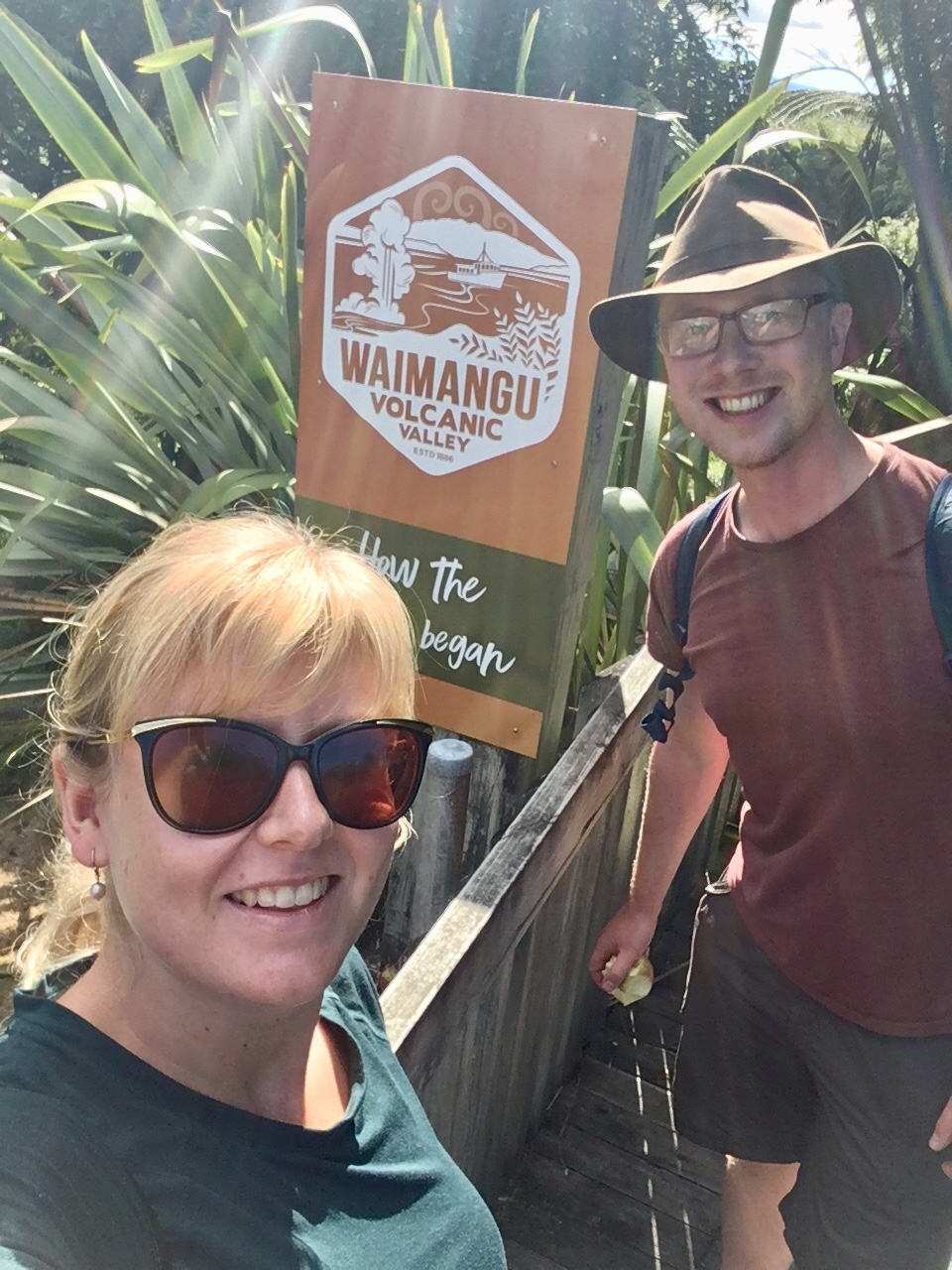
This is reputedly the world’s youngest geothermal area, having been created by the eruption of Mt Tarawera in 1886, and the only one wholly created as a direct result of a volcanic eruption. It is home to “Frying Pan Lake”; one of the world’s largest hot springs, and “Inferno crater lake”; the world’s largest geyser-like feature, without being a geyser!! It’s an active volcanic region, so it is littered with beautiful geothermal terraces and colourful lakes, pools and streams. A pretty awesome sight!
After catching the bus back down to the start we had just enough time to head over to the Polynesian Spa to enjoy the hot springs before I had my massage. It was a beautiful setting to enjoy the hot water, looking out onto the lake, and the massage was pretty wonderful too. Aaaaand relax.
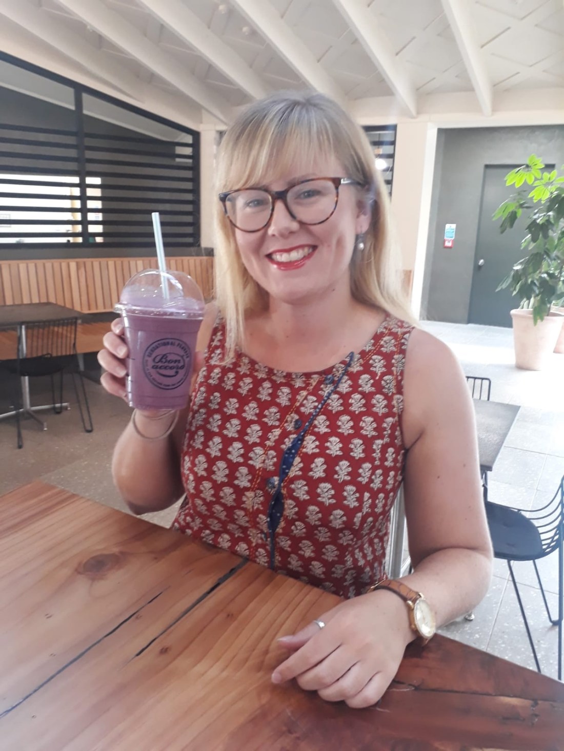
Another lovely shower and some make up (the first in a while!), and I was ready to go for a birthday treat meal out. Before we left though I was given a voucher for a free juice drink – I chose the smoothie called ‘The Rachel’! They got it right (apart from the spelling of course); blueberries and raspberries – yum!
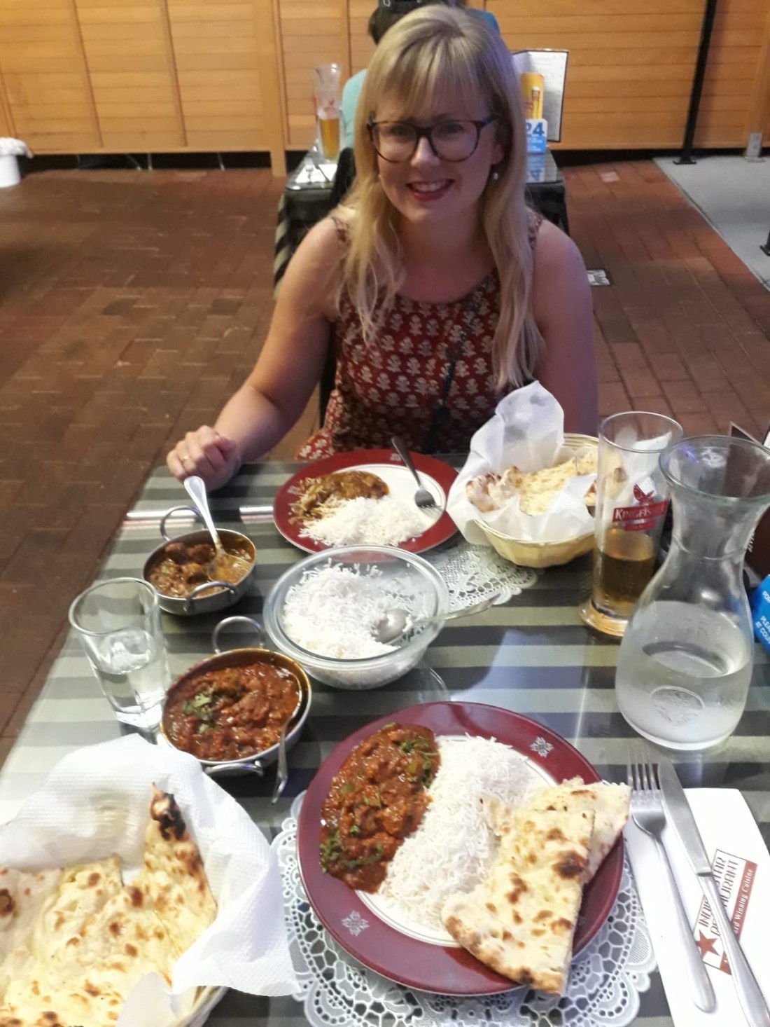
For my birthday meal out I chose an Indian, as this is possibly the food both of us had been craving the most, and it was pretty good, especially when washed down with a few cold Kingfisher beers.
Suitably stuffed we headed back, doggy bag in hand, to our lakeside parking spot. As a side note here, this is not where we had planned to stay for the night. Our car park of choice was full, so we had no other option than to head down the dirt track to the dead end by the lakefront. Although a scenic spot, it was not as pleasant on the nose as the eyes… and the flies, well, they were fully moved in and very sociable. It didn’t matter though as we were headed out for the night.
So, when we arrived back from town and saw that Ged had accidentally left the lights on, we quickly realised this was NOT the thing to do in a bright lime green car by a sulphurous stinky lake – the van was literally SWARMING with flies. Countless flies. There was nothing for it but to quickly fling open the door, jump in and shut it again before beginning the process of swatting all the ones who made it inside!
All in all a memorable and great day to welcome in my 33rd year.
11 March – Lake Taupo
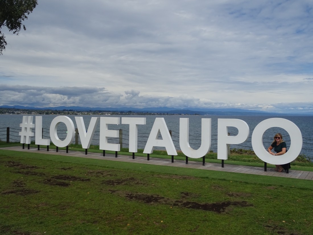
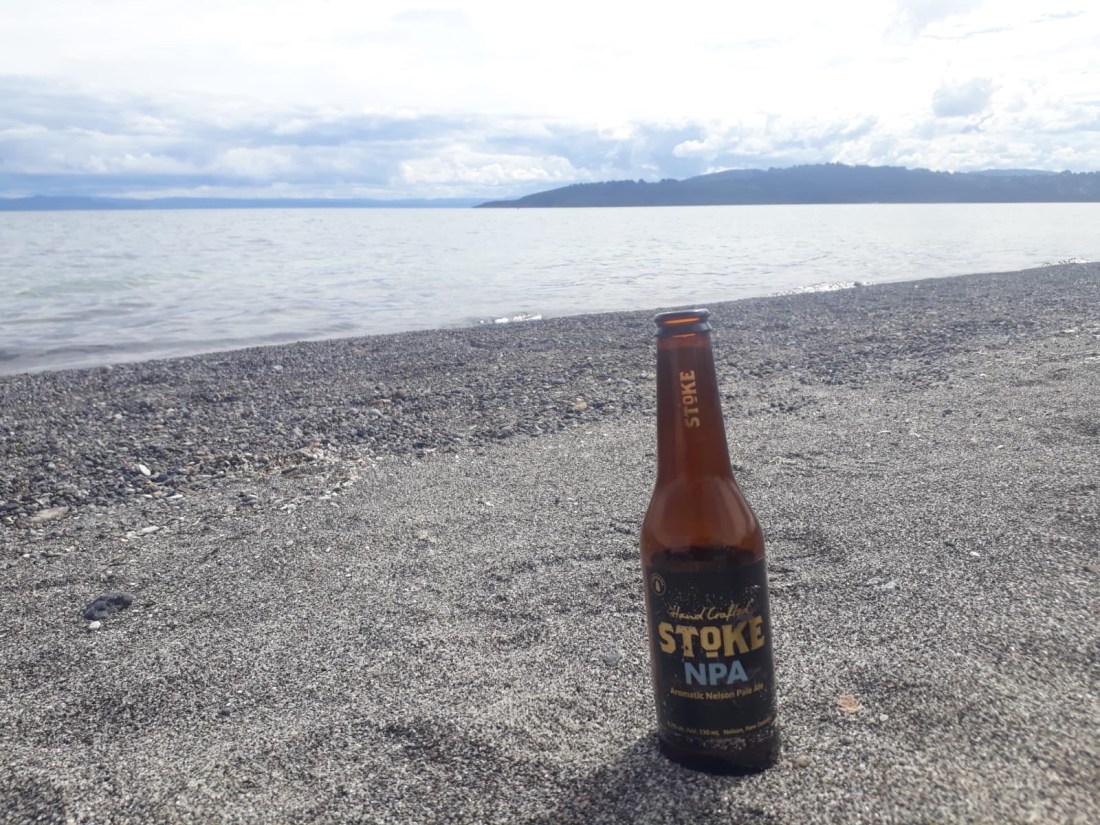
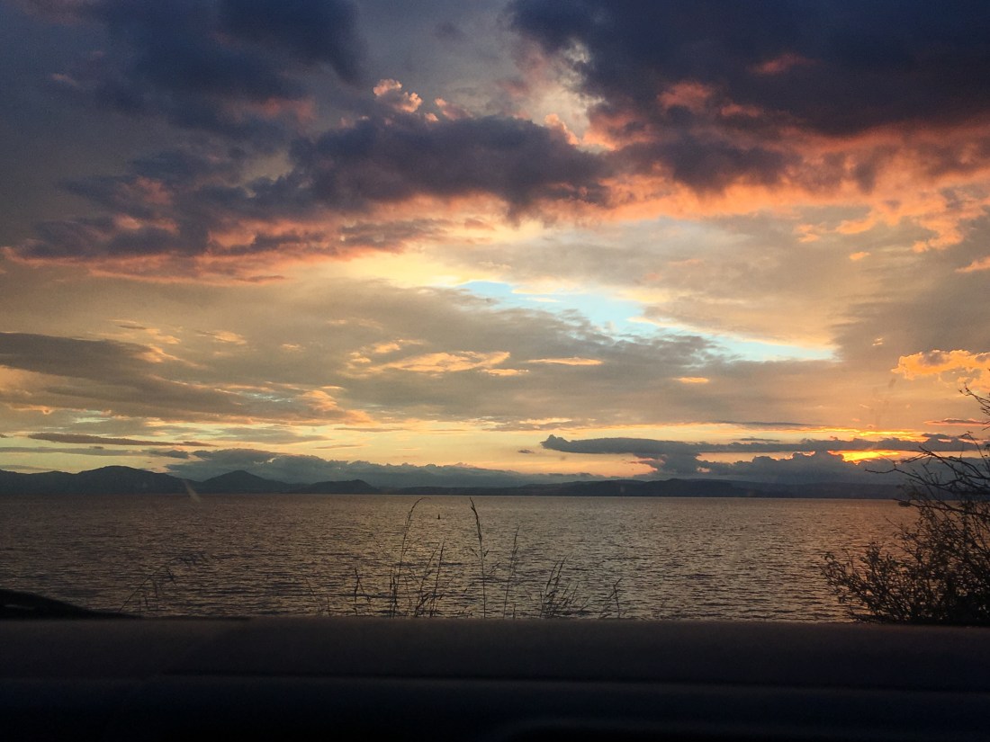
Today was all about preparing for our big bucket list item on the North Island, the Tongariro crossing. We decided to move to Lake Taupo in order to get closer to the start point, and to rest up ready for the 19km trek. We arrived in Taupo and did some essentials – another shop at our value supermarket of choice; Pak n’ Save (food is quite unaffordable here if you don’t shop around!) and a visit to the local I-site (visitor information) to book our one way Tongariro shuttle. After that we headed to a lovely lakeside campsite spot, this time without flies(!) and enjoyed the good weather with beers on the shingle beach.
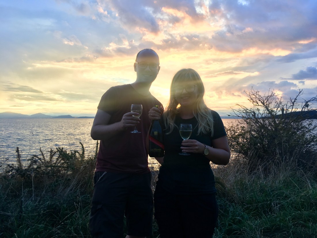
A good opportunity to catch up on blog writing, and then Ged cooked a big chilli (or as big as we could manage in our little saucepan!) which would keep us going for the next two nights. As the sun began to set we opened a beautiful bottle of champagne in our temporarily nicknamed “champervan”(!) which Chris and Carol had sent us away with for Rach’s birthday. Heaven! Tongariro here we come!
12 March – Simply walking into Mordor
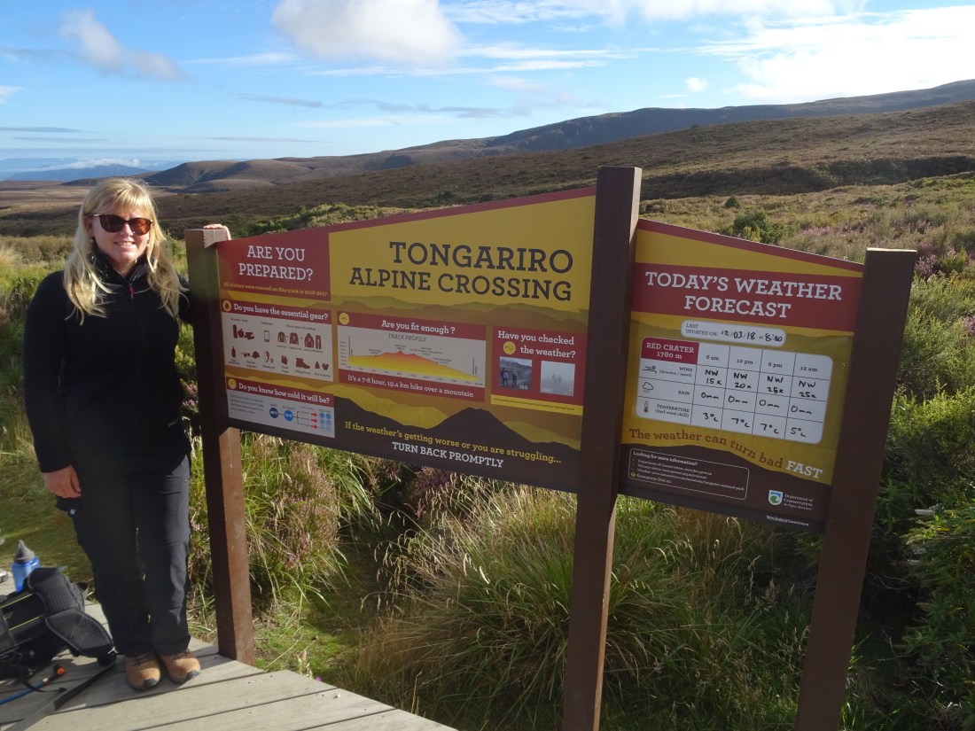
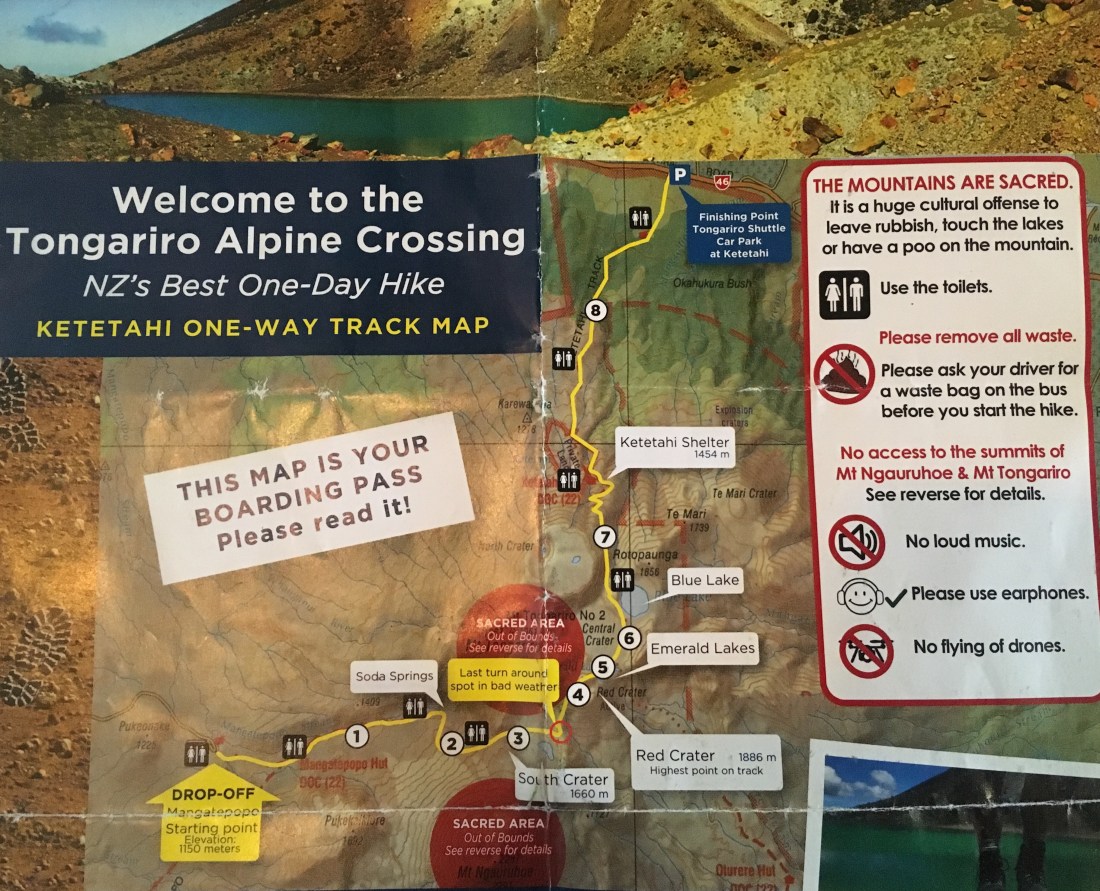
Today promised us one of the best hikes in the world. A true bucket-list trail that might make most other walks seem mundane. We were initially annoyed that we had to pay for a shuttle bus if we wanted to do the full day hike as the only nearby public carparks have a ludicrous maximum time of four hours!!! We had to pay an outrageous $35 NZD per person (about £19) to park near the end (Ketetahi) and take a 17 minute shuttle bus to the start point (Mangatepopo), which was the cheapest way of doing it. The walk is worth the money but we loathed paying this for a public walk. The shuttle companies must be making thousands of dollars a day thanks to the government public parking rules in the area. GGGGGRRRRRrrrrrrr. Rant over.
Shuttle aside, the Tongariro Crossing truly delivered. We started the trek very well prepped via the numerous warning signs about fitness levels and when to turn back etc(!), at about 1150m above sea level.
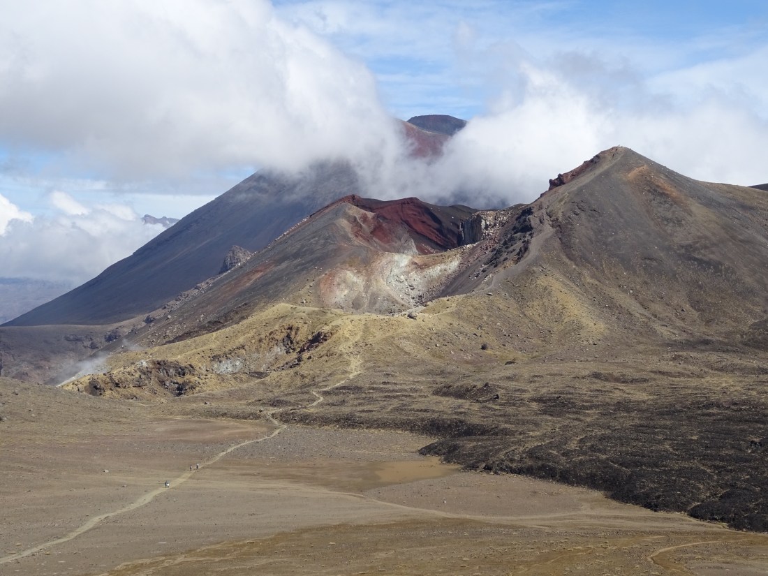
The first part is relatively flat and straight forward and we set off on little cloudy but promising weather day. The clouds gradually cleared to reveal the majestic cone of Mount Ngauruhoe as we trunched along. A bare and bleak summit, this volcano is probably known by most as Mount Doom from the Lord of the Rings.
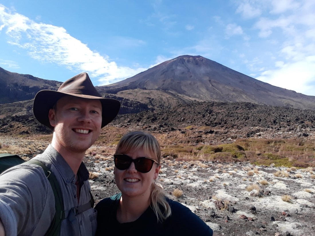
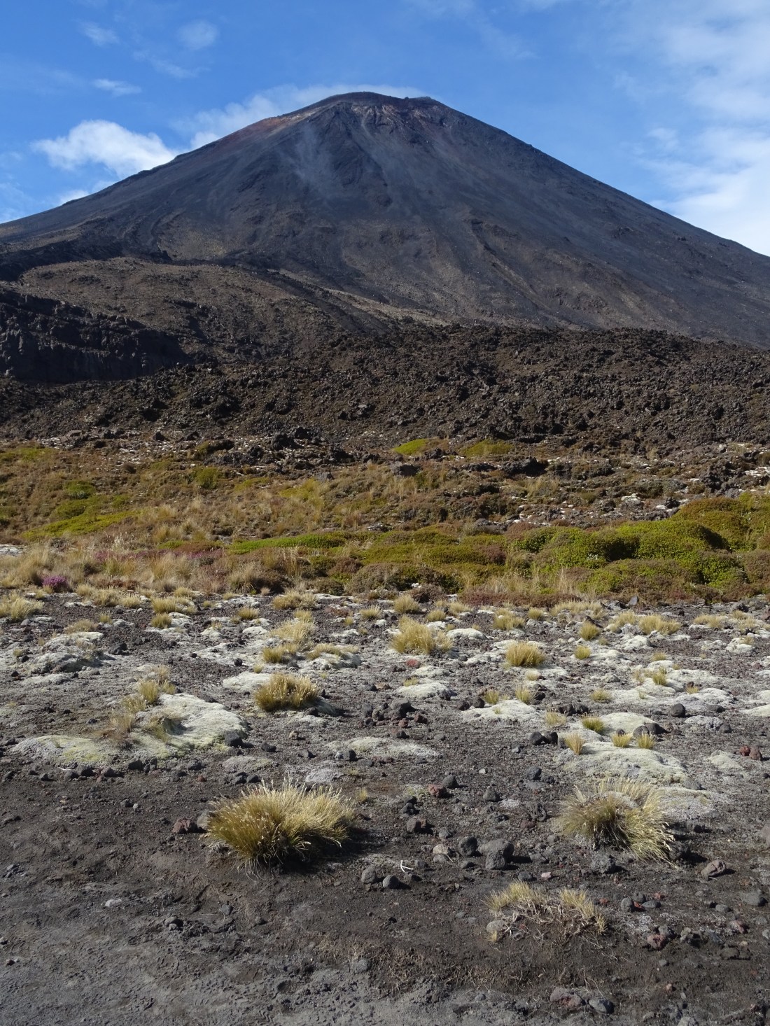
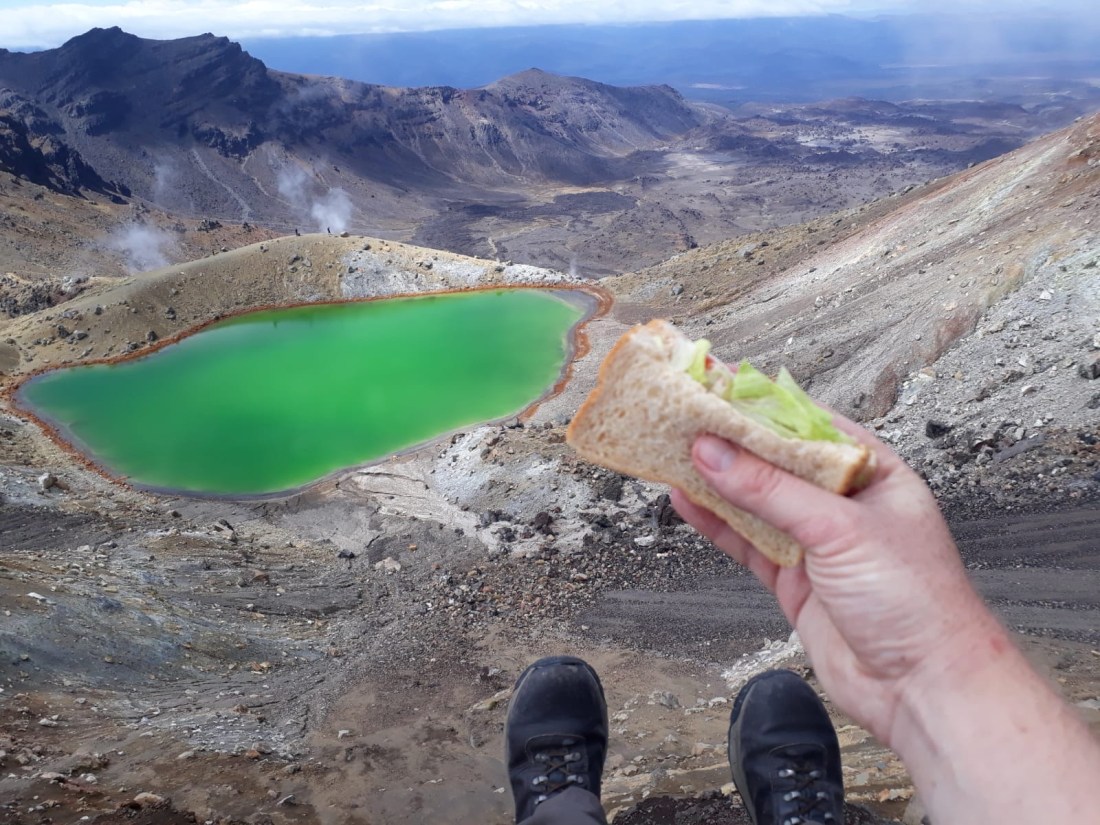
This barren volcanic area was used as a location for Mordor in the films and as we climbed up into the volcanoes we certainly felt like Frodo and Sam, gazing up at the challenge ahead. Well, except we carried precious tuna butties to destroy at the fires of Mount Doom instead of a ring with squiggly writing…
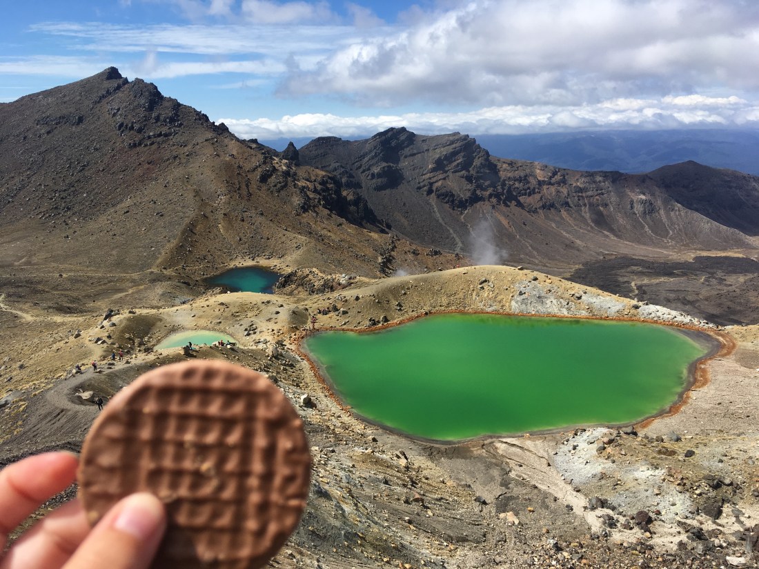
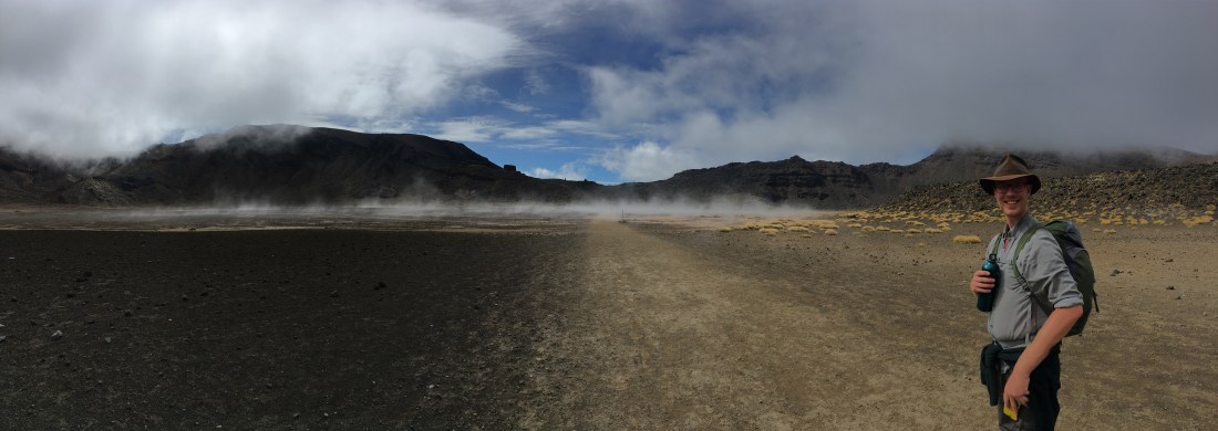
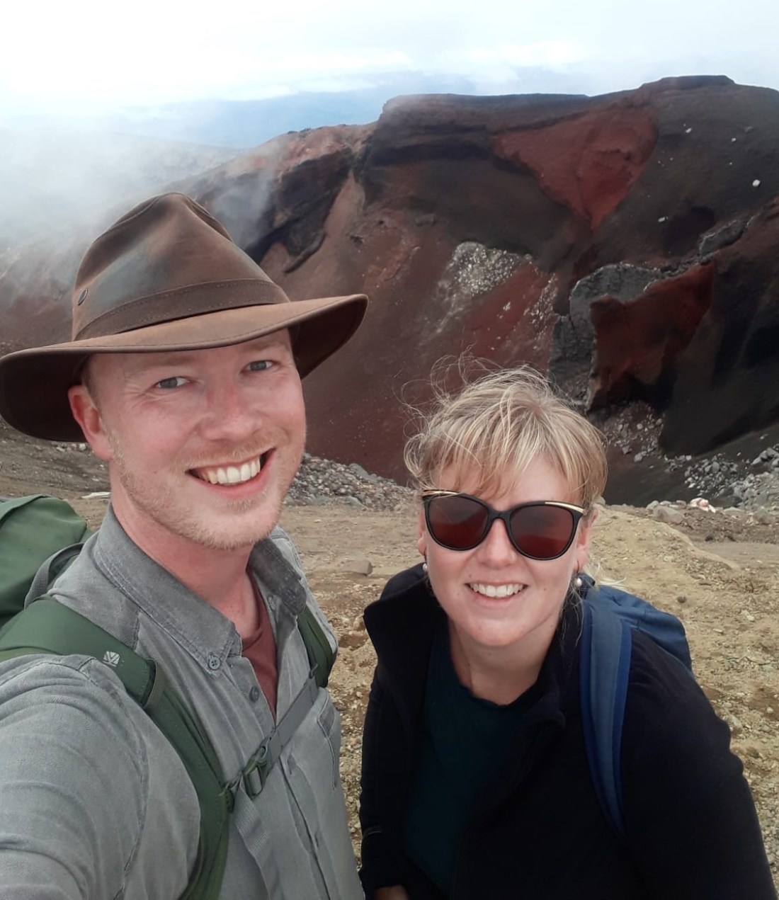
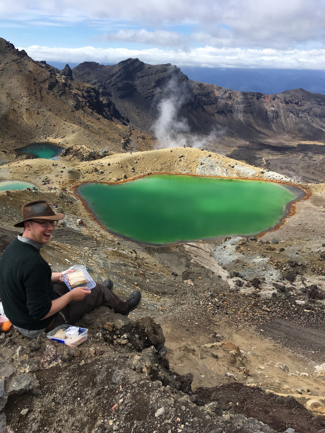
We climbed steadily higher until we reached a section known as the Devil’s staircase. A real calf stretcher. It seemed to go on forever until suddenly the ground plateaued and we were inside the South Crater. Surreally flat, mist and gas drifted across the ground obscuring the view and making the next summit seem softer than it is.
As the mist cleared we realised we were about to start another challenge. The steepest part of the track loomed above us and we dug our heels in as we scrambled up. We would have reached the top (1886m above sea level) in brilliant time but we couldn’t help but take in the truly dumbfounding crater views as we climbed, slowing us down.
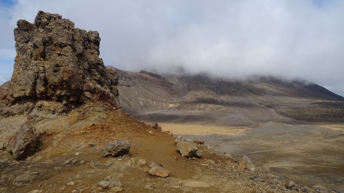
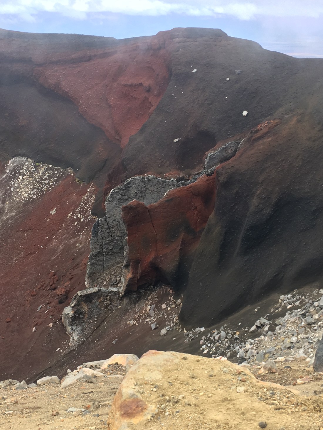
As we finally hit the highest point the most angry landscape unfurled below us. Blood red escarpments, rocks frozen mid-explosion, and grey, razor sharp formations.
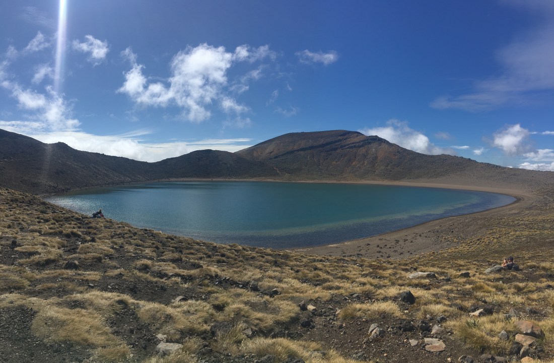
But this furious scene was juxtaposed with the utter serenity and beauty just below it. The sight of the emerald and turquoise pools surrounded by sulphur-stained rocks truly took our breath away.
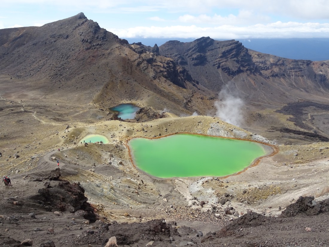
We only made it half way down the sliding scree to the pools before we had to take a seat and truly admire this view. Coincidentally it was also about 1pm, so this was probably one of our most picturesque picnic spots ever.
What was even stranger was that athough the air was cold, our bums were warmed by the rocks reminding us that this volcano is merely sleeping.
Butties and biscuits demolished, we carried on down for our few more photos of the emerald and blue lakes – Ged’s favourite may have been the little one that combined the two! Jump shot opportunity!
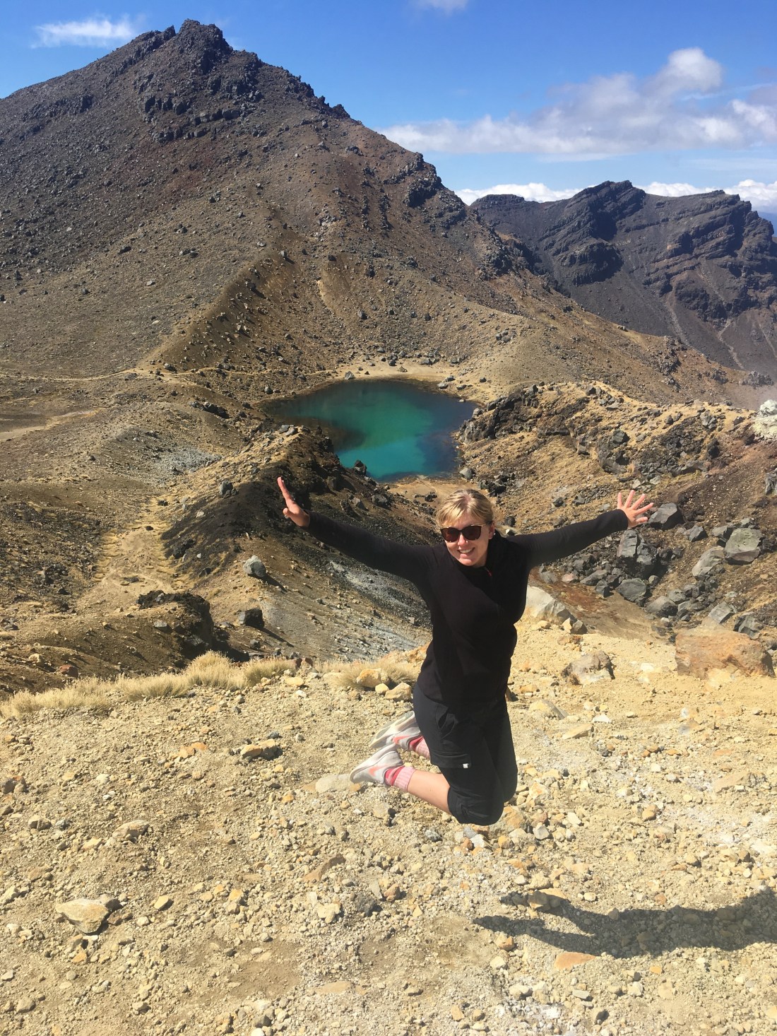
We eventually and reluctantly headed out of the central crater to the last summit of the day. Looking back we could see the violence that had made the red crater and the emerald pools. A gigantic frozen lava flow covered the central part of the crater.
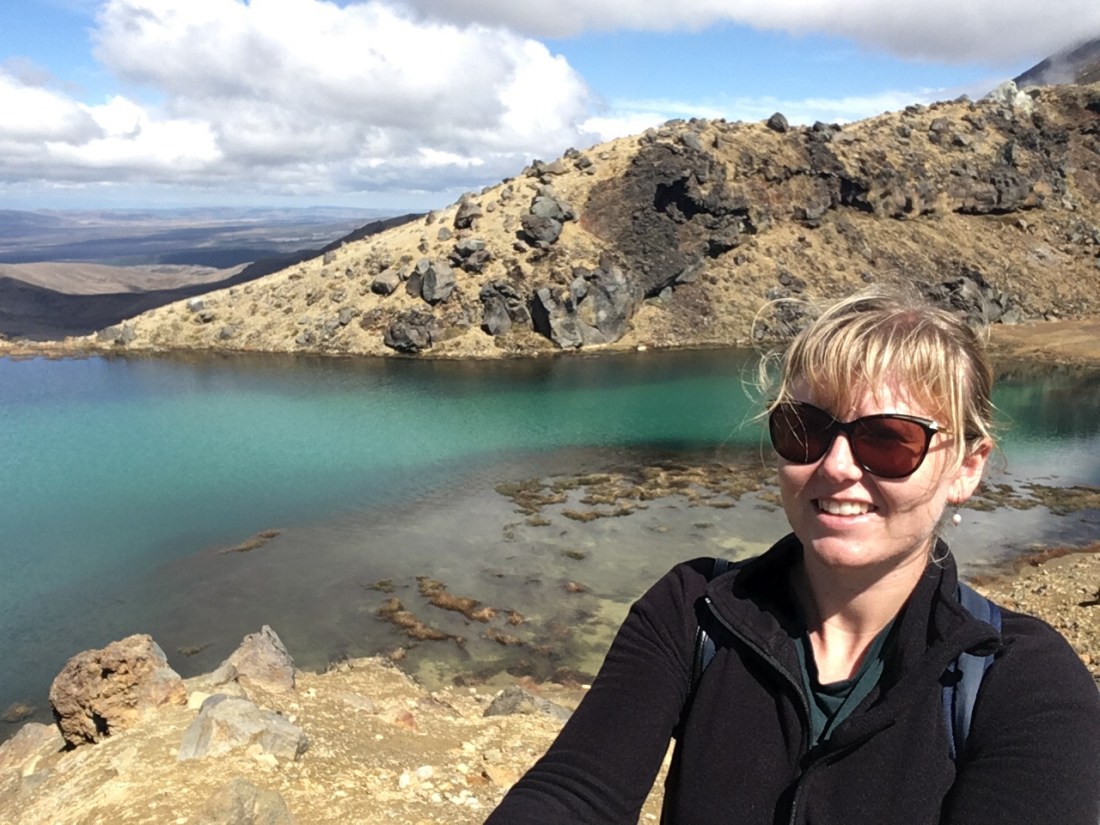
The sheer power that created this landscape is something else! We carried on and as we crested this final peak we saw the blue pool. This larger lake is beautiful, but much more imposing than the emerald pools.
It took us a while to realise it, but around this pool was the first vegetation we’d seen in hours. From this point on our hike was down hill, vegetation growing thicker as we went. Moorland giving rise to woods, then forest as we neared the end, but the volcano still making its presence felt by giving off jets of steam in many different places across the hill. About a mile from the end, we saw a sign in the woods saying there was a Lahar hazard. What the hell was a Lahar??? Not being able to look it up we wondered what manner of creature was preparing to jump out at us.
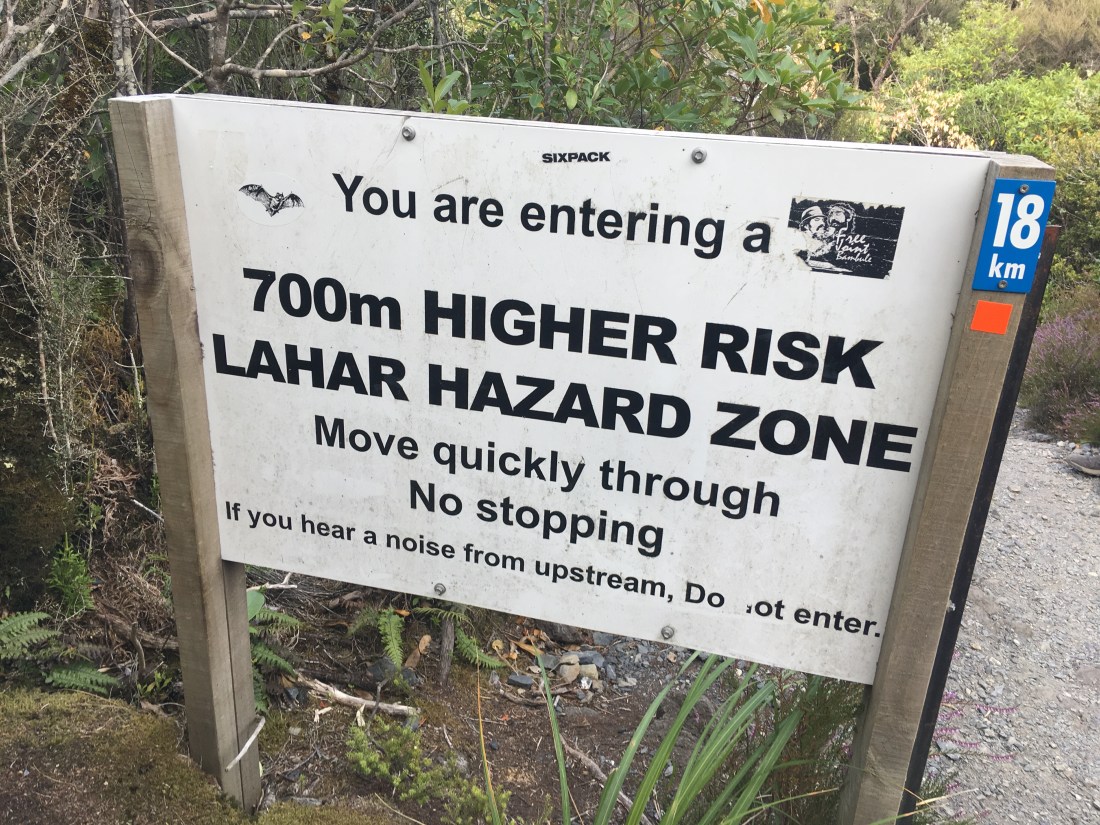
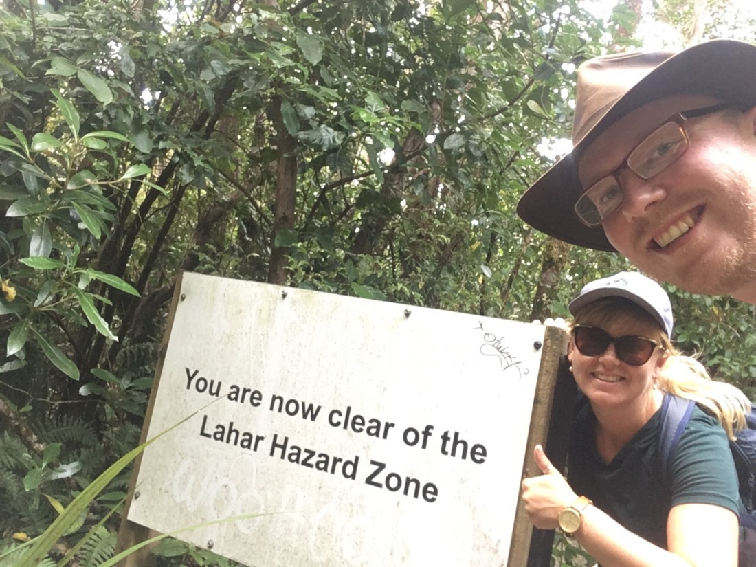
The sign said to move quickly and not to stop so we hoofed it down the path following a stream until eventually another sign said the danger had passed. Phew!
We’ve since learned what it was (check it out here) – it does sound kind of dangerous!
We finished the crossing trail at a leisurely pace and high fived at the end sign (750m above sea level) knowing we’d done a good job with the 19.1km (11.9miles) we’d just covered. We would have done it in under seven hours if we didn’t stop for pictures for about two hours. It wasn’t a race though and it is easy to lose time merely staring at the view.
Annoyingly our car park was a mile further along the road than the end of the trail. Our moment of triumph at reaching the end was short lived as we tramped down the highway to discover we were one of the last people in the car park. We didn’t care really. We’d had such a thumpingly good day. We headed north back to the same campsite from the night before on the shore of Lake Taupo, an hour away. Grateful for batch cooking tons of chilli the day before, we ate hungrily and conked out rapidly, barely having time to comment on how relaxing the sound of the lake water was.
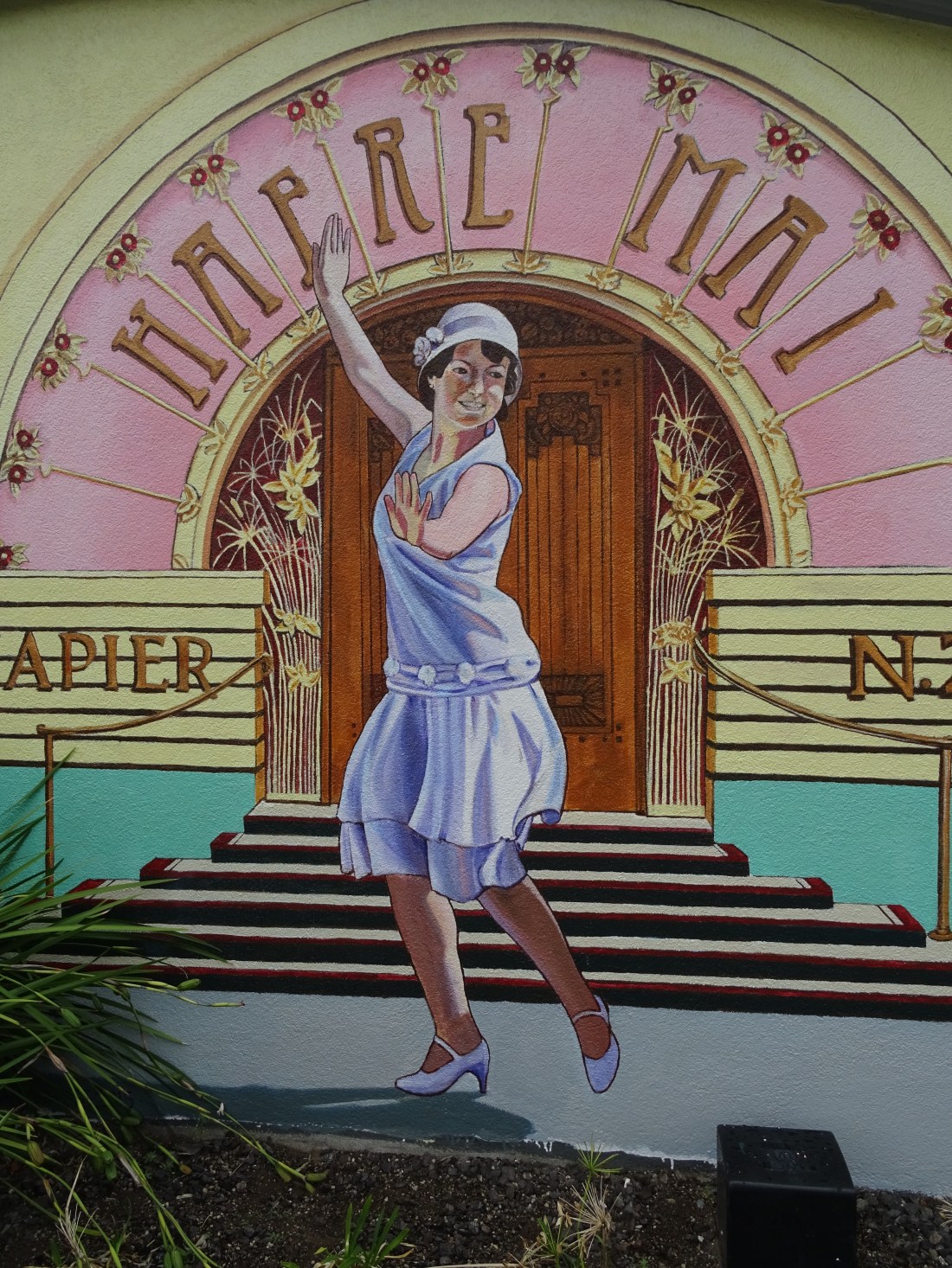
13 March – Napier, the Art Deco town
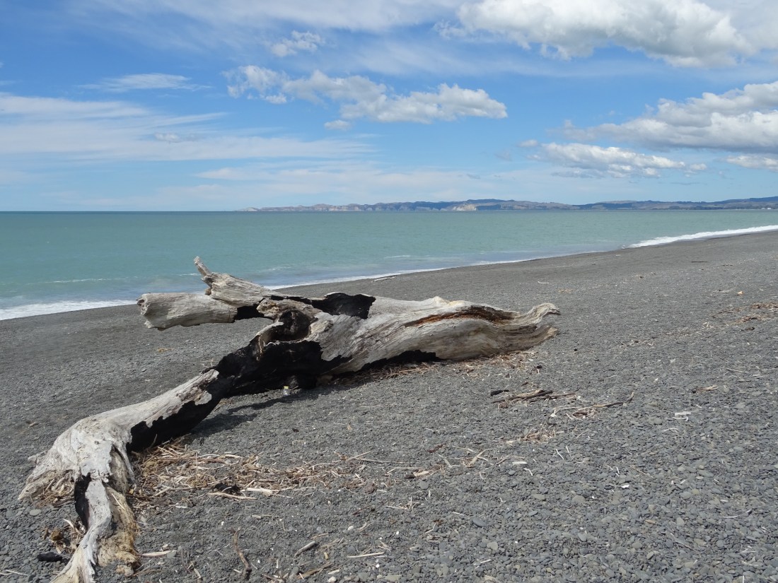
After our only 2 consecutive nights in the same camp site, and another first on this trip – a sausage butty – we set off for a new destination; Napier! We were tired from Tongariro, so intended this to be an easy day. However there were miles to drive, so we were still up fairly early to get to Napier by 11am. We parked up by the sea at another scenic camp spot and then walked down the promenade.
Our weather luck then wore off again as the sunny skies immediately went grey after Rach put her sun cream on. Can’t have it all! Our mind was set on fish and chips so off we wandered to find them. Turns out the only place we could get them was quite a walk away and up a long hill. We went anyway! It was nice to have a big portion of chips and battered fish, and we filled up so we wouldn’t need any tea that night.
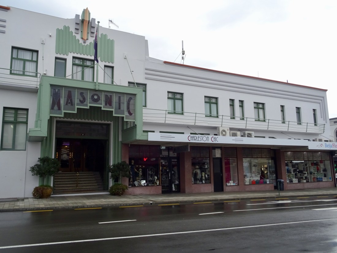
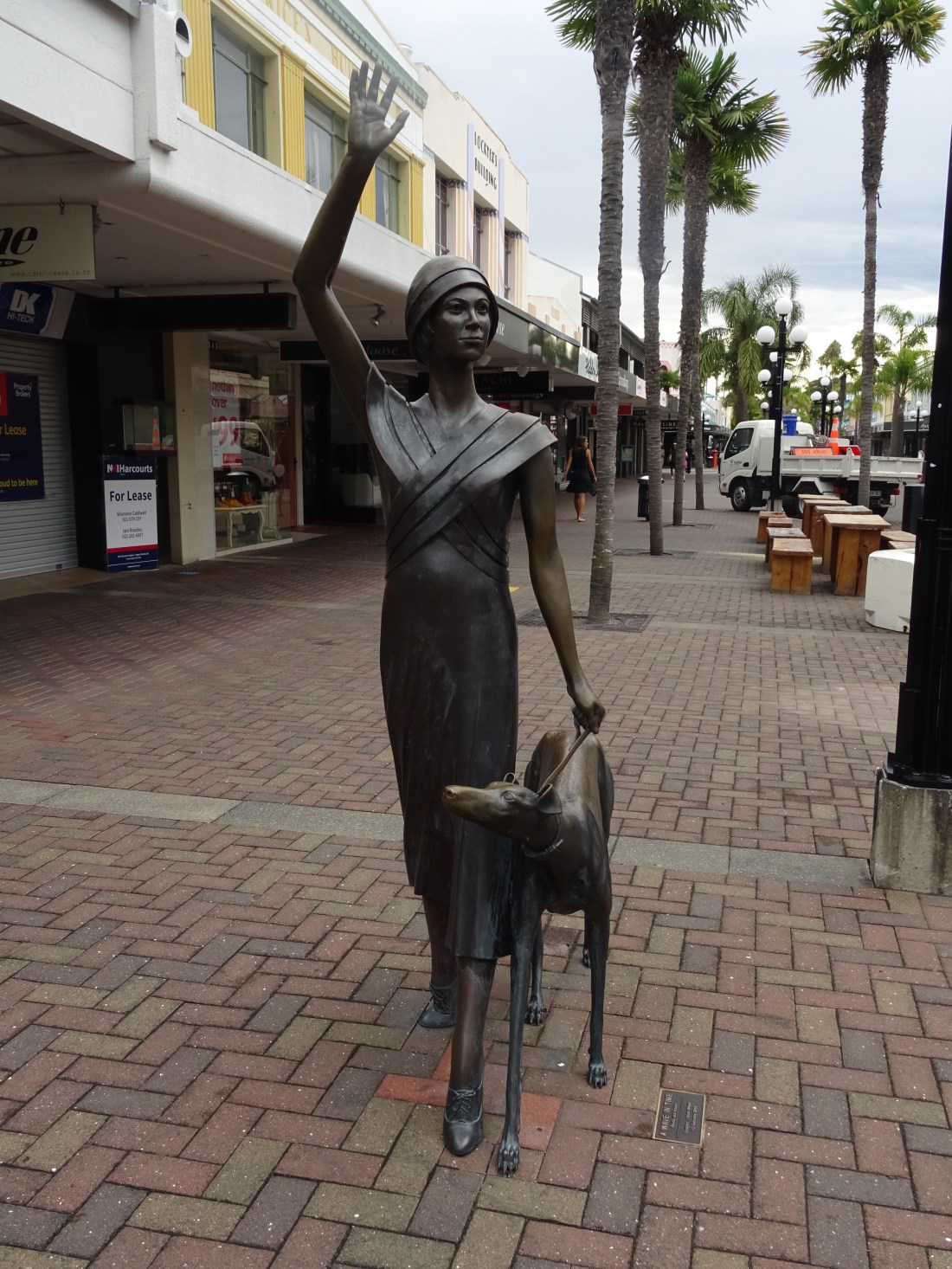
We then had a few hours to explore this Art Deco town. First up was the museum, to learn about the earthquake that was ultimately responsible for the distinctive and authentic architectural style which has been a hallmark of Napier ever since. The museum provided a short but well-presented insight into the destructive 7.8 magnitude earthquake that killed over 250 people back in 1931. The strength of the quake equated to the detonation of 100 million tonnes of TNT. Hard to imagine what that must have been like, channeling down the fault line that runs directly under Napier. This is only one of 22 locations in Hawke’s Bay that is volcanically active so of course there’s nothing to say something of this scale won’t happen again someday, but let’s hope that loss of life can be prevented by quicker action thanks to today’s predictive technologies. We left having seen exhibits of items found in the aftermath of the quake, and having heard accounts of those who had experienced the earthquake first hand. It definitely made us think about how lucky we are in the UK to not have to ever worry about losing everything in a matter of seconds in such a punishing natural disaster.
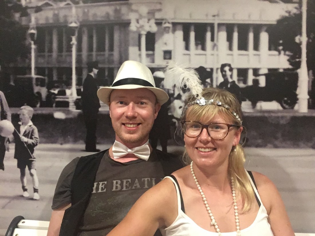
After the museum we wandered around Napier, taking in the beautiful buildings that had risen from the ashes of the earthquake, and a quick dress up in our own Art Deco attire!
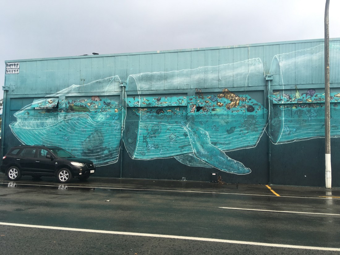
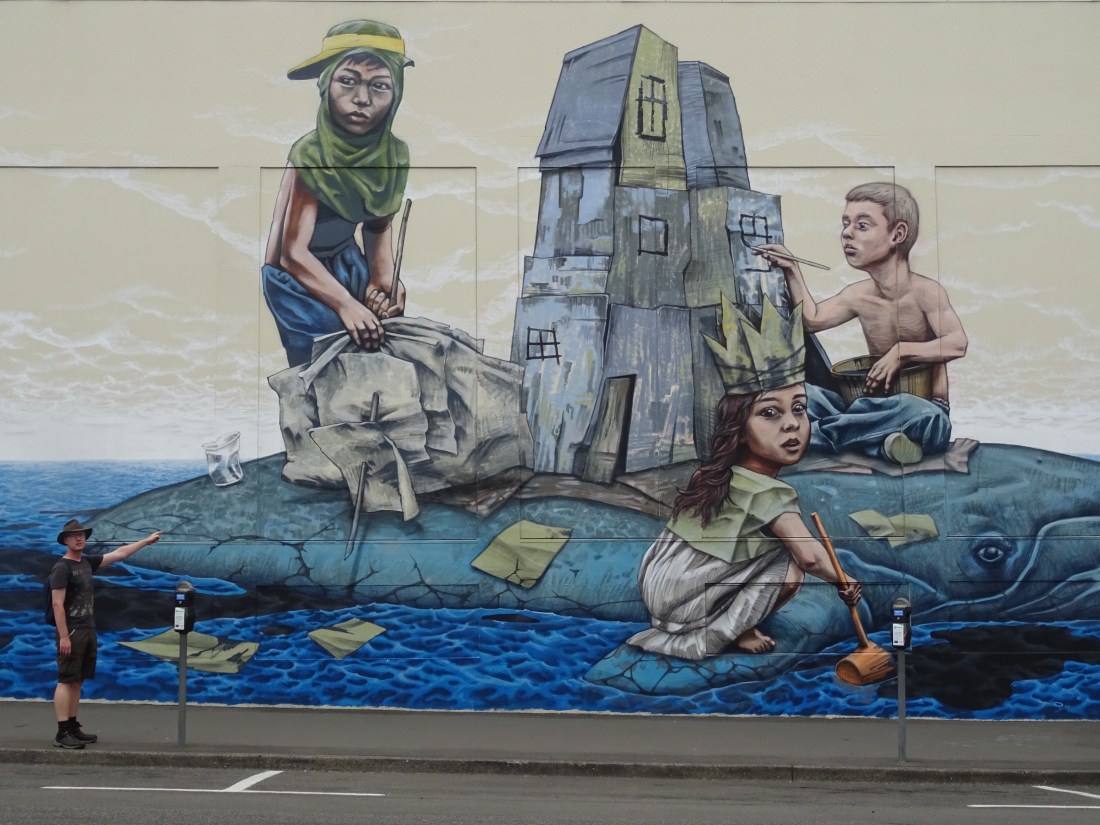
We enjoyed spending time admiring the street art dotted all over Napier. Made by artists from across the world, they all depict the modern day environmental disaster of plastic pollution. Here are a couple of our favourites:
After strolling around we then decided to walk to the little harbour village of Ahuriri for a pint at the Thirsty Whale. What a long walk it was! Raining (again) and hilly, we realised our rest day had probably turned into about 10 miles, but exercise is always good for you! We walked home tired but fulfilled from a busy day, ready for our last on the North Island tomorrow.
14 March – Last full day on the North Island
Unbelievably we have reached the half way point of our trip, as we get ready leave the north island. So we were going to make it count! As you read this final section of the post you could therefore be forgiven for thinking that the events took place over several days. We assure you that the happenings we here recant occurred within sixteen hours, or thereabouts. Easily our busiest and longest day in New Zealand so far.
Our day started before the day really. In the pitch black of night we dressed, clambered into the front seats, and set off not long after 5:30am. We didn’t see a single car ahead of us as we made the short drive to the top of Te Mata Peak to watch the sunrise. Never before have we enjoyed such a view whilst munching weetabix.
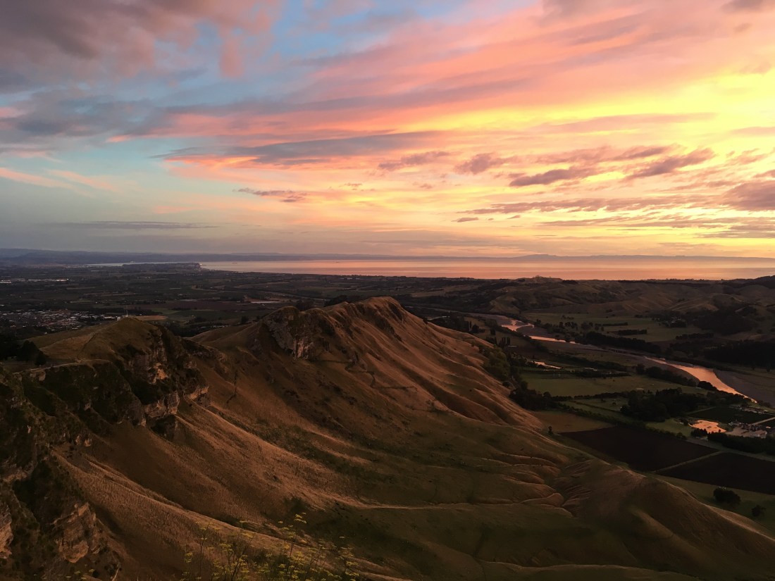
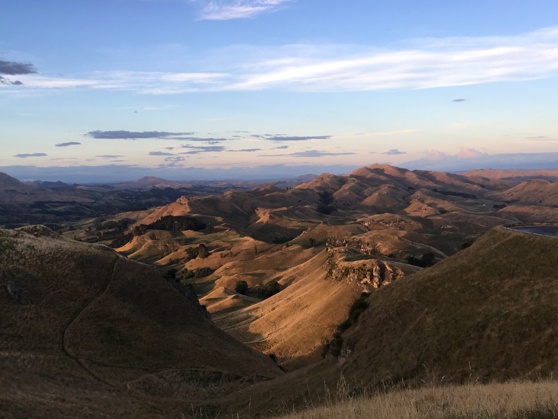
The landscape reminded Ged of Stanidge Edge in the Peak District, but with the ocean in the distance. As soon as the sun was above the horizon we set off again, leaving behind those annoyingly chirpy people that jog up hills at the crack of dawn.
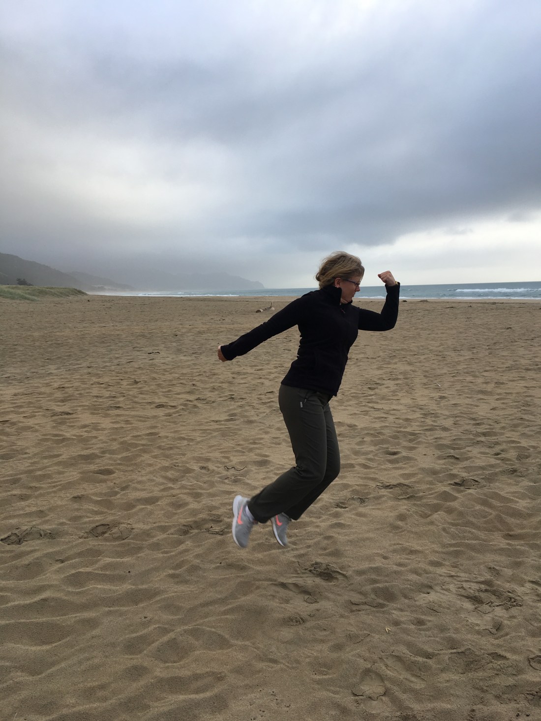
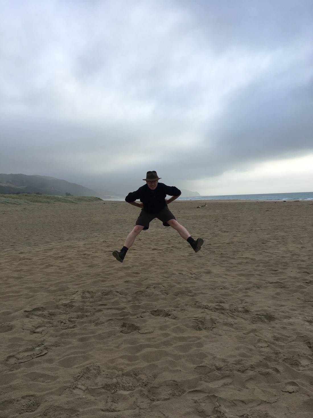
From our viewpoint at the top of Te Mata we had seen the east coast and decided to head to the beach. Despite Google maps’ best effort to get us lost we arrived at a place simply called Ocean Beach. The place was deserted and the golden sand was all ours as the sun had barely risen in the sky. No time to rest though. After a couple of Rach’s signature beach jump photos (this time with a twist!) we hit the road again.
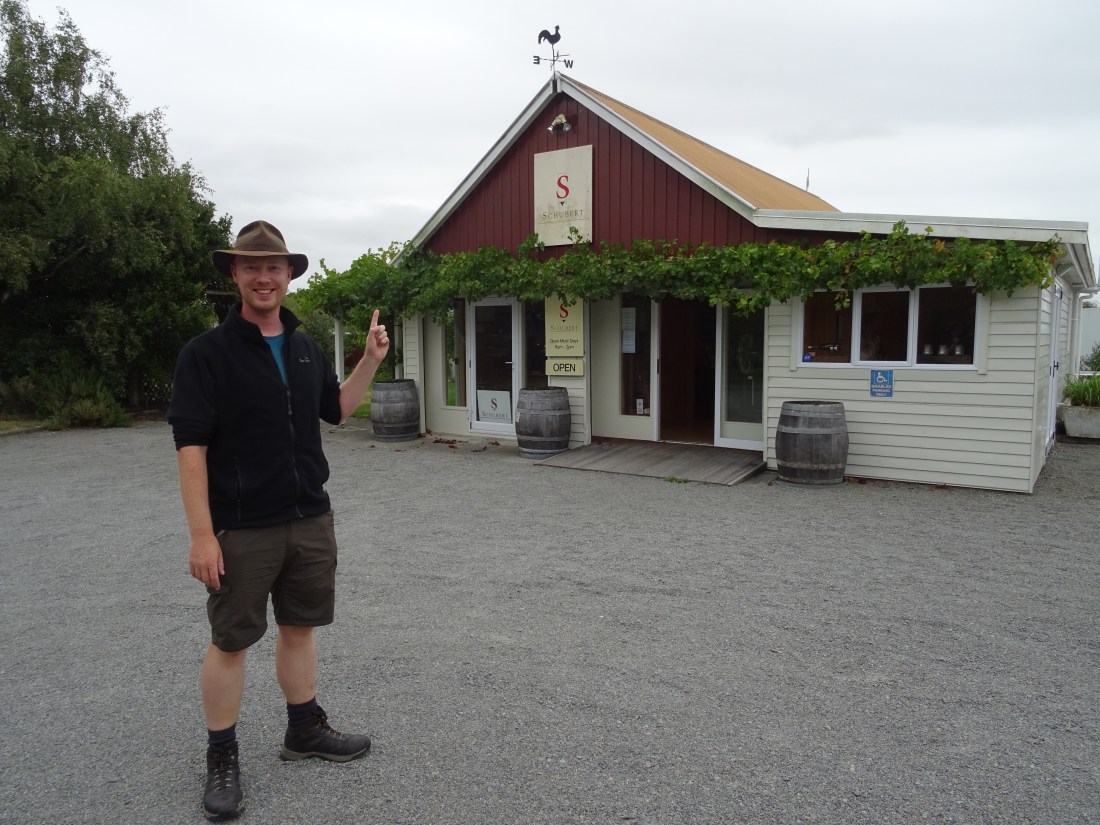
Wine country. You know when you’re in it. Miles and miles of vineyards line the road to Martinborough which was our next destination for the day (3.5 hours of driving later). The thing to do here is hire a bike and cycle around the different wineries sampling the produce of the region. There was no time for us to cycle around though so we pit-stopped in the van at the Wine Bank first of all. In this place all types of local wine are encased in glass cabinets and you are issued a “bank” card to withdraw tastings from taps above the bottles. For us the Sauvignon Blancs were the winners. We spent about NZ$14 and tasted six wines.
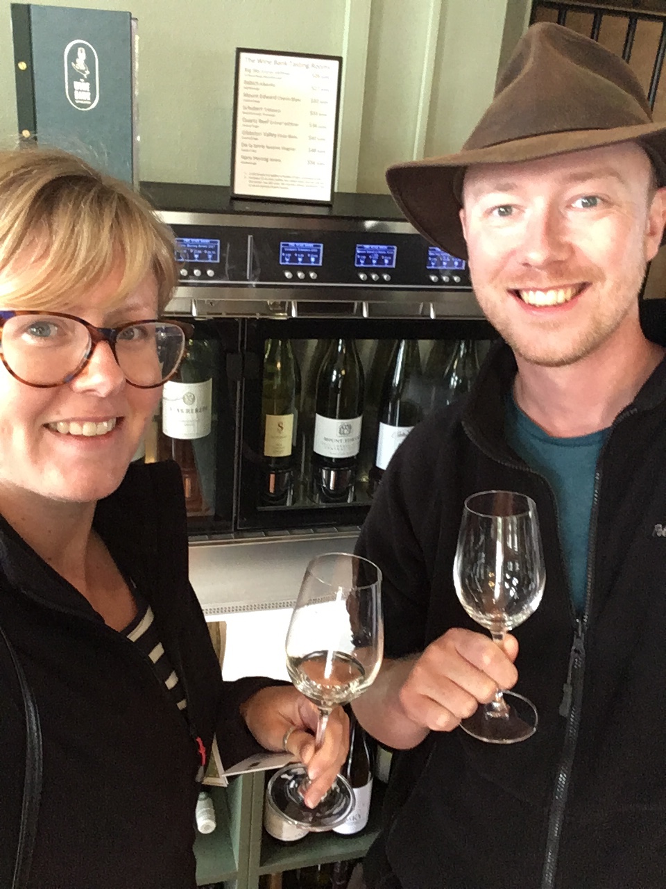
However, this was essentially just a bar in town and not a winery proper. We only had time for one so picked one we liked the name of. Schubert was our selection (bloody music students….) and was only half a mile away from the town centre. Turns out we scored good style. We were treated to a tasting of their entire range, including an excellent Sauvignon Blanc and one of the most intriguing wines we’ve ever tried.
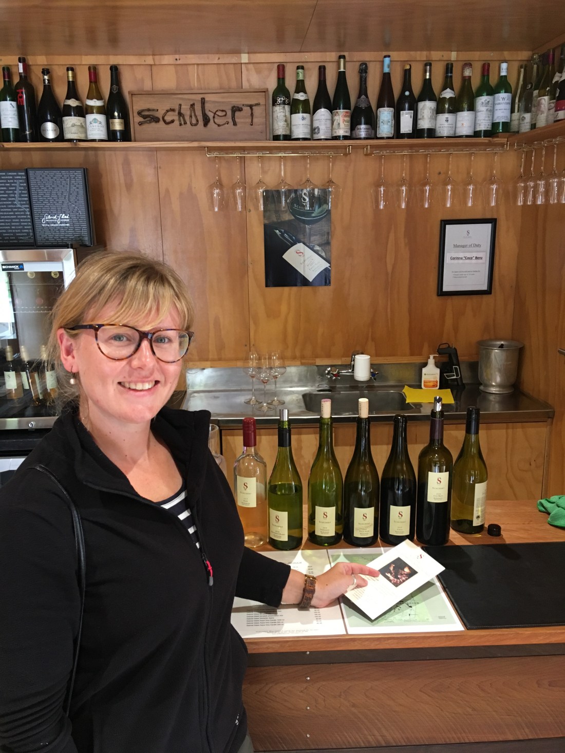
This little family run, organic, and hand picking vineyard has recently introduced a complex blend of Pinot Gris, Chardonnay, and Müller grapes. The wine is hard to describe. Initially sweet and fruity, then savoury and oaky, it was delicious. We ended up buying a bottle of their excellent Sauvignon Blanc and spent NZ$23 for the bottle and the tasting. Happy bloody days. No rest for the wicked though…..
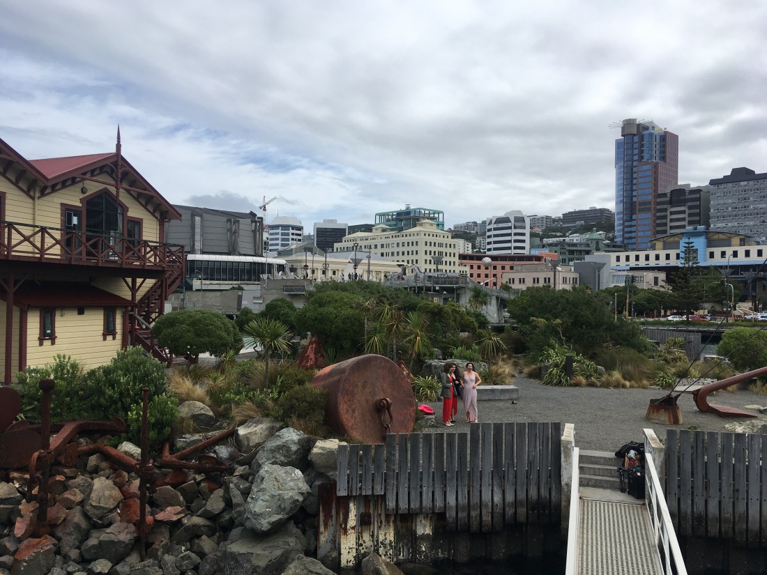
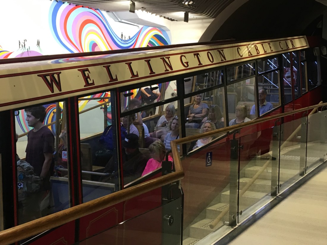
Our last destination of the day was Wellington city some 1.5 hours away. However, there was still no chance to chill out. In fact, it was necessary to split up to see what we wanted. Ged went to the Te Papa Museum (Museum of New Zealand) and Rach went to ride the cable car and get a view of Wellington, which she did from both the cable car top and from the harbour edge.
Ged only spent a couple of hours in the museum and again could have spent days (running theme!!) The museum is free, huge, and brilliant. There are exhibits on Maori culture, Pacific island life, art, immigration, the founding of New Zealand, farming, conservation, tourism, earthquakes, and the most recent addition is an exhibition on the battle for Gallopoli during WWI. The exhibition was achingly beautiful, sad, and awe inspiring. It told the stories of individual soldiers and a nurse at different times through the battle and included their personal accounts as well as artefacts from the battle. This in itself would make an amazing exhibition but the “big” difference here are the 2.5 times lifesized models of the people discussed in the exhibits made by nearby Weta Studios (more on them later). The level of detail on these models was astounding, right down to the individual hairs on a soldier’s cheek who hadn’t shaved for a few days.
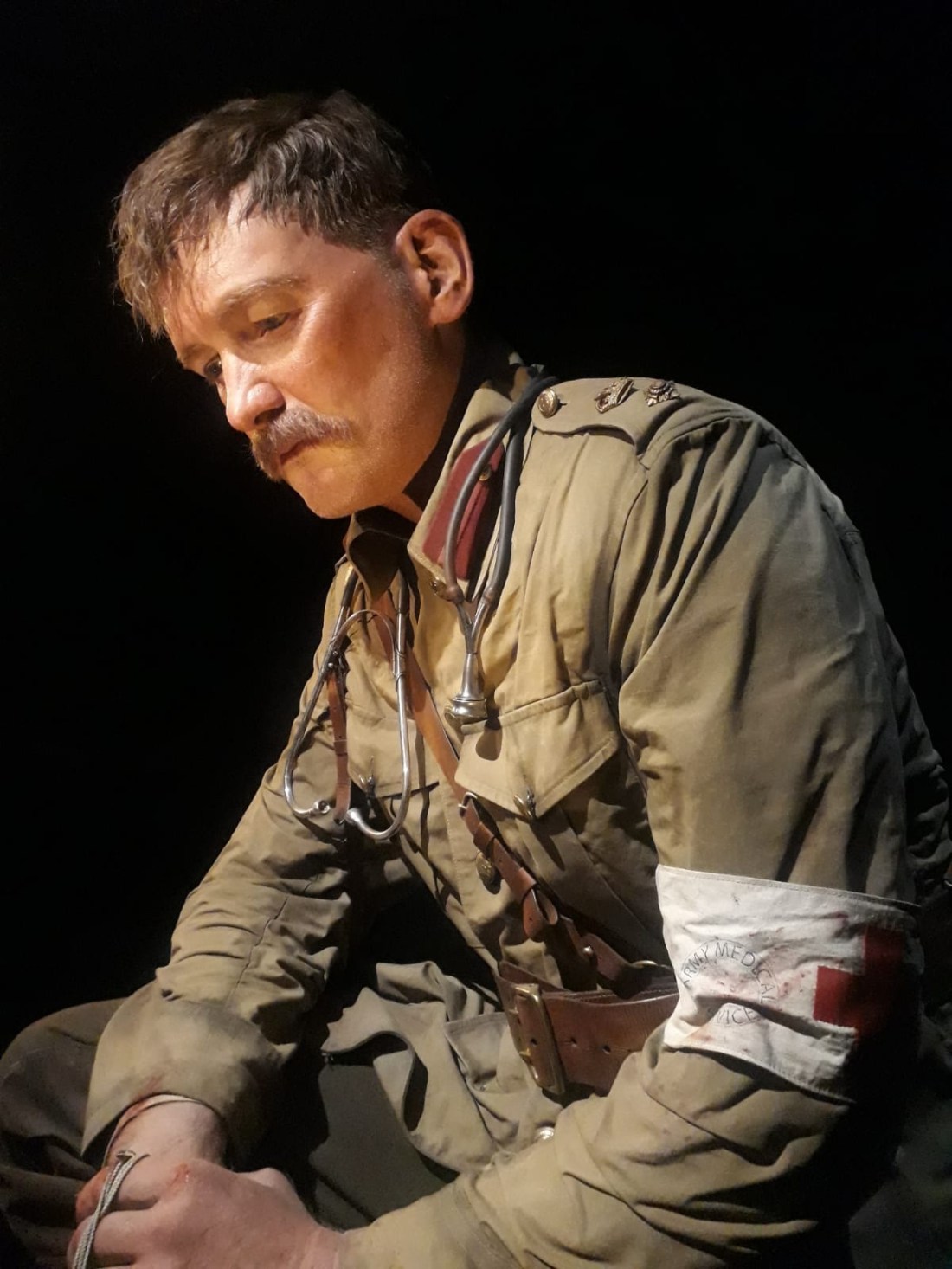
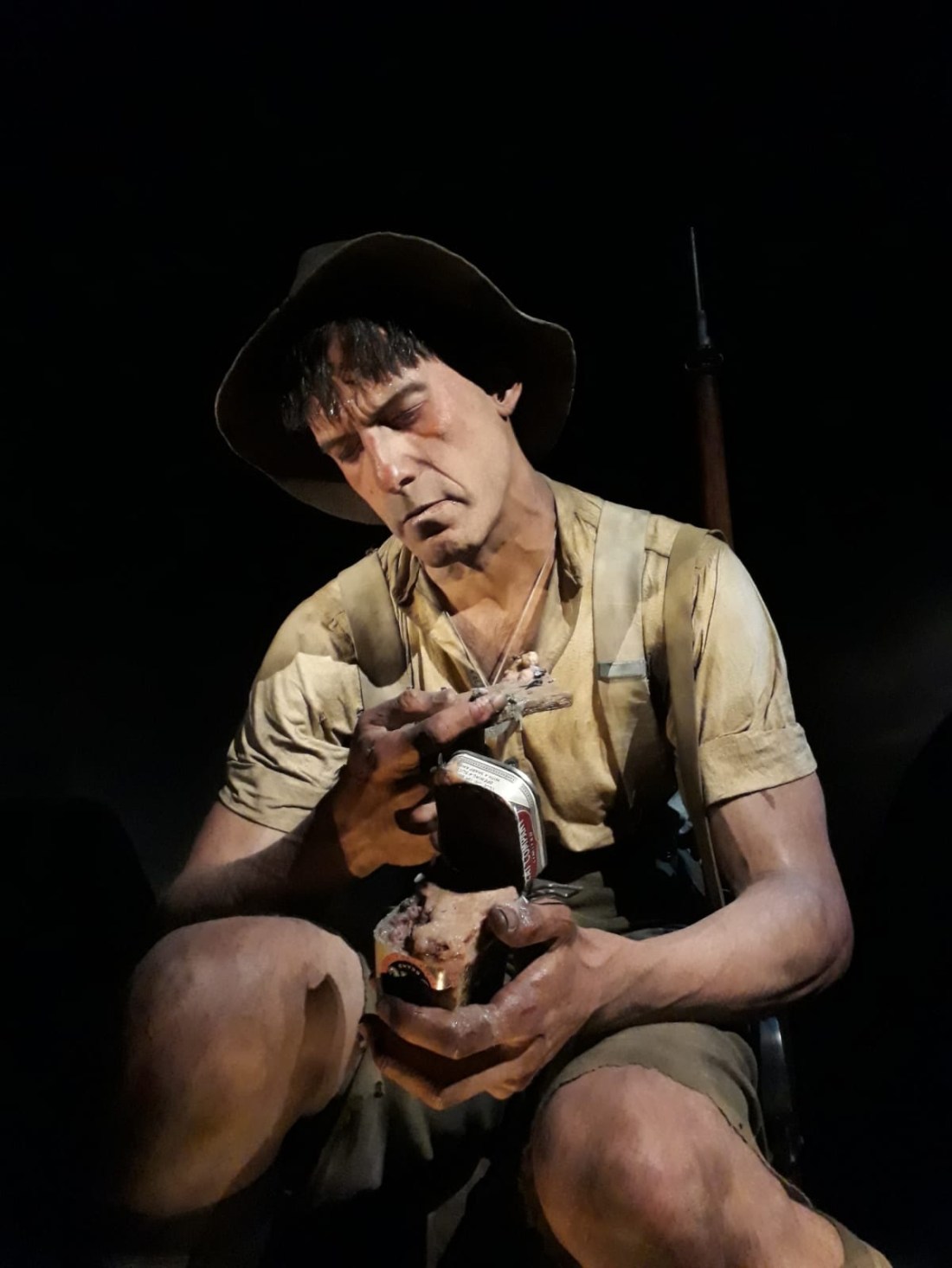
Their size hits you straight away and the raw emotion rendered on their faces somehow makes their stories more real than if an actual person was telling you. Ged learned a lot about the horrors of Gallopoli here, but this could also have been an exhibit about true masters of model making. Go if you are ever in Wellington.
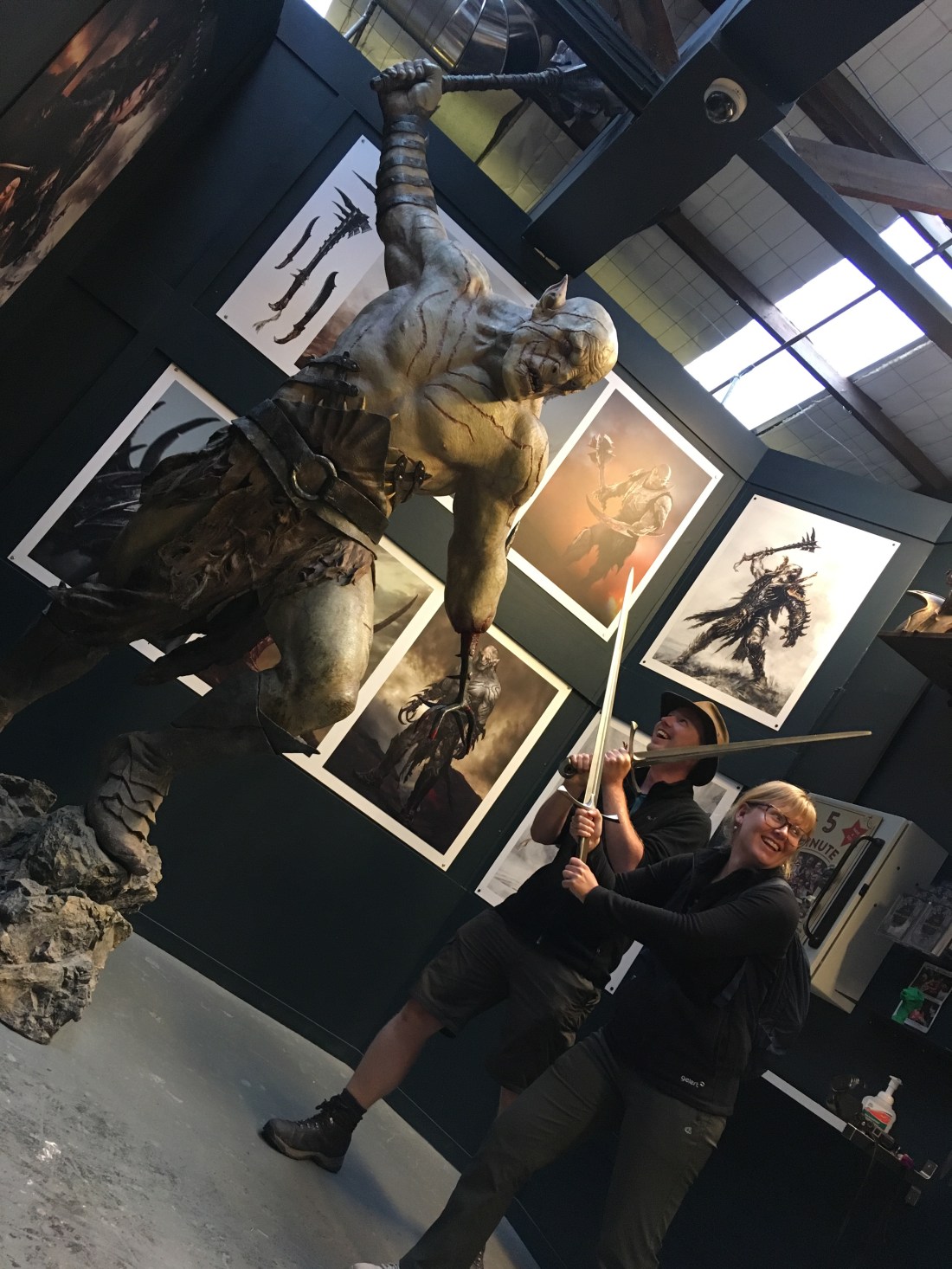
Our next stop on this tornado of a day was the Weta Cave, not far from the city centre. These studios have made the props, costumes, and special effects for SO many TV series and films over the last three decades, but they are probably most famous for their work on the Lord of the Rings films.
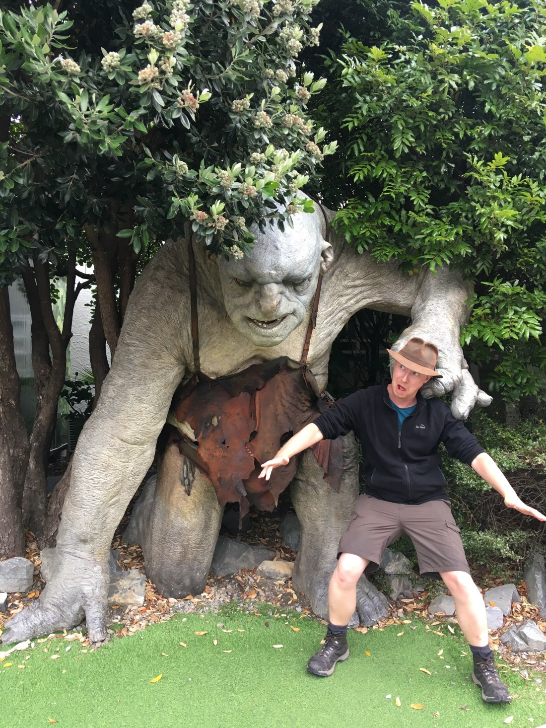
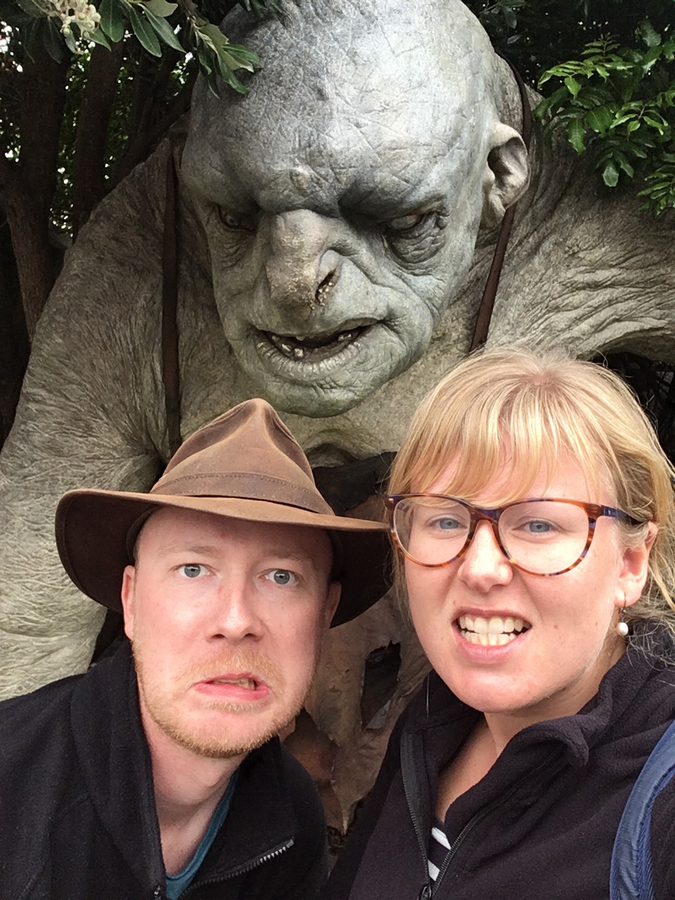
We booked the last mini tour of the day (5:30pm) for just under £15. It turned out that we had a private tour as no one else booked for that time. Winner!! As the tour started we were offered a sword to carry made by the studios. These are meant for children but there was no way Ged was going to pass up a chance to wield a sword made by the “elves.” The tour was simply amazing. We saw the whole process from concept art, modelling, prototypes, 3D printing, blacksmithing, painting, robotics, prosthetics, makeup, hair, and costumes. This was like an Aladdin’s cave of movie magic. We couldn’t take any pictures inside, but a grin never left Ged’s face the whole time and he declared that this is where he wants to work when he grows up. Just look at him wielding that sword at the end of the tour!
So, so worth the cost of the ticket.
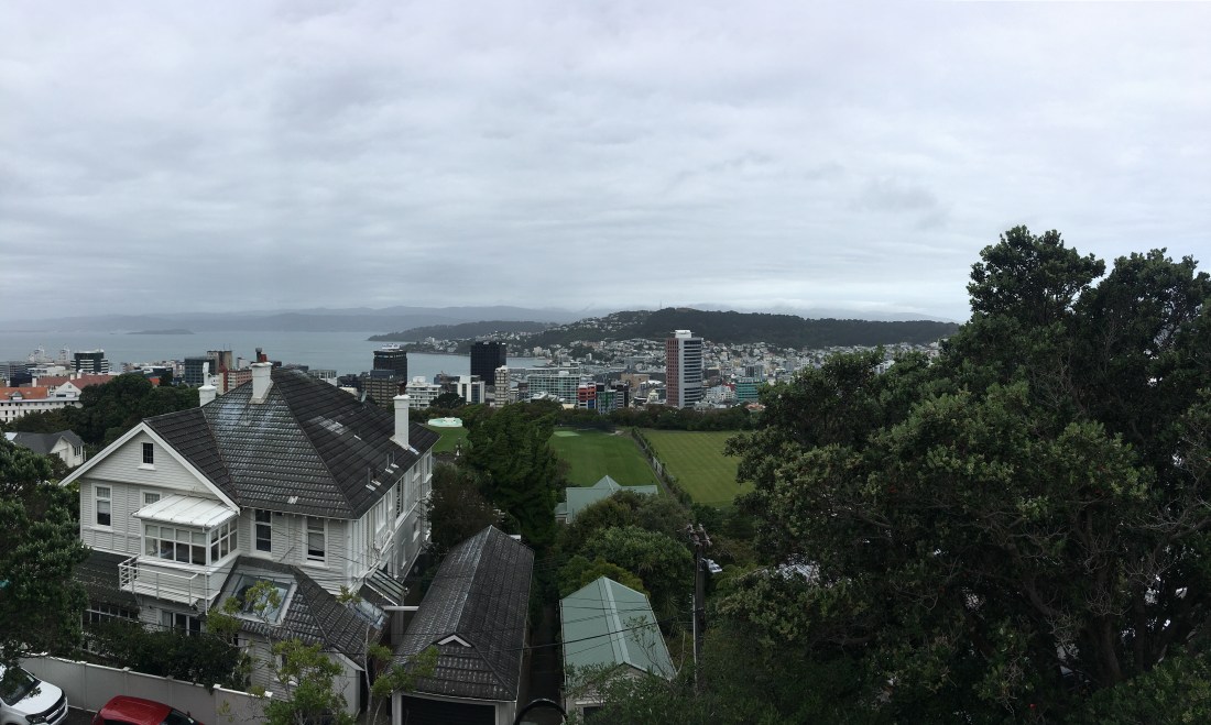
Our last scheduled stop of the day was the top of Mount Victoria near central Wellington. This blustery bastion of rock gives an excellent view of the city and information about how much of the land has been reclaimed from the sea. This is a popular end point for joggers and cyclists and no doubt the view is worth the effort getting up the hill.
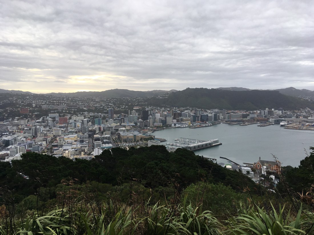
Satisfied with the view, we sped down the windy road to our planned camp site near the marina only to discover it was full. We got a tip from another camper about a quiet spot across the bay in front of some white buildings so headed off to find it.
As the road hugged the bay we saw fewer and fewer buildings, white or otherwise. Eventually we found a car park in front of what looked like an abandoned school, holiday camp, or asylum… The sun was nearly down and there were no street lights. The creepy vibes were on full blast! Ged went to investigate as Rach put a couple of beers in the fridge. He gingerly approached the white wooden buildings and saw a sign saying “Shelly Lodge.” Think Shaggy rather than Fred from Scooby Doo… The buildings were empty, and although most were padlocked shut, some had no doors at all and anybody, or anything, could walk in. Ged didn’t enter, thanks to the big signs in some windows warning of asbestos contamination, despite how much he wanted to explore the big, dark, spooky buildings alone!
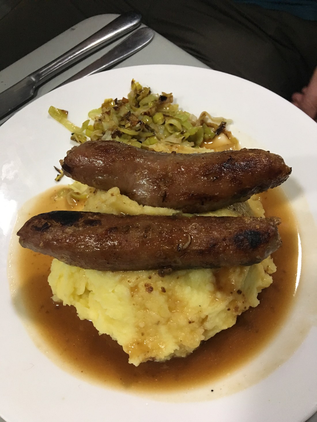
Before grub we opened a cold beer and went over the day. No wonder we were knackered!!! From our free camping spot in Napier to the creepy lodge in Wellington we had done some 6.5 hours of driving and 292 miles. That didn’t even include the time we’d spent seeing places. What a bloody day. Suddenly, at about 9pm we were famished. Ged had been banging on about bangers and mash for days and finally got to have his wish. Cheap sausages, proper mash, grilled leaks, and bisto gravy. Proper northern camping grub.
The stodge was needed after such a long day and was comforting enough to help us forget the horror film setting we were camping next to. The lights of Wellington and the ferry terminal could be seen from the rear window twinkling across the bay; beautiful and silent at night. Tomorrow would bring the South Island and perhaps a more rugged adventure. How were we going to top the last few days though?? We would have to wait and see.
