
Author: Rach (21-24 March) & Ged (25-28 March)
Photos: Rach (unless specified otherwise)
21 March – Glenorchy > Fiordland national park
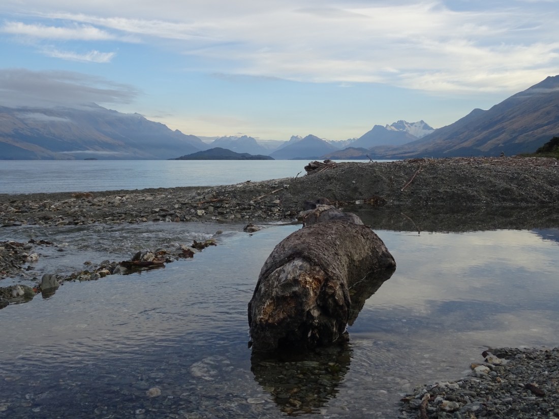
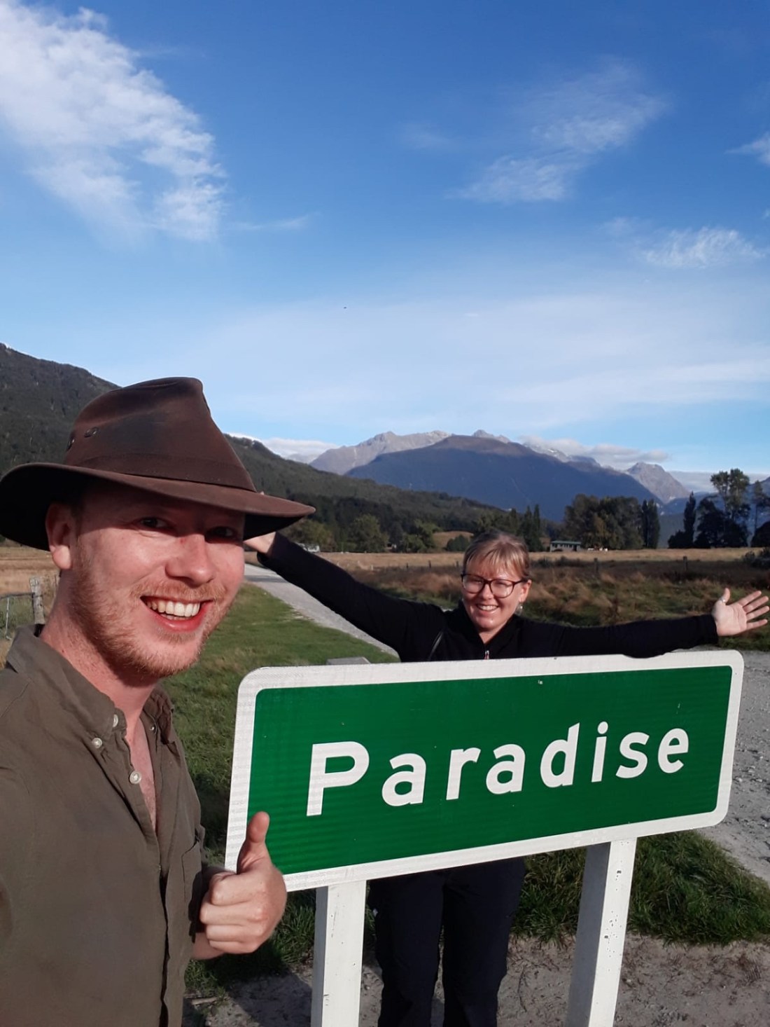
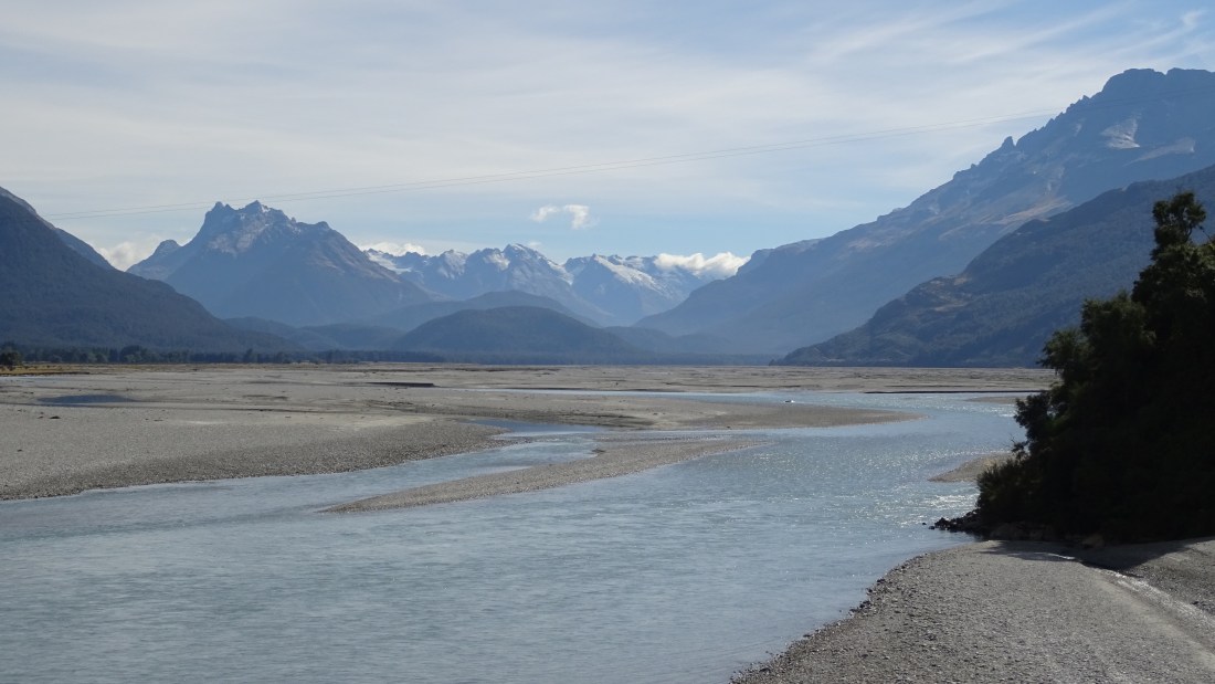
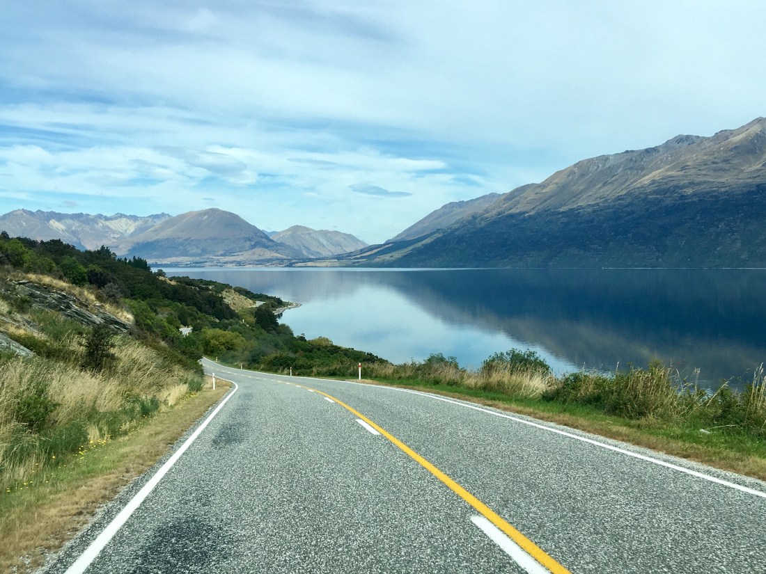
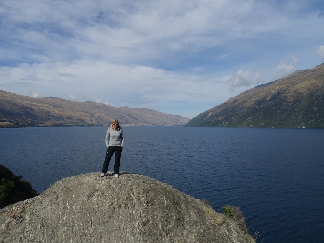
We woke up at our sublime lakeside campspot, where the last blog post left off, and had breakfast and got on the road by 9am up towards Glenorchy itself. The day was as beautiful as yesterday and the lakeside views as we rounded each corner were a real treat. Once at the top of the lake we took a track off north, up towards ‘Paradise’ no less(!), to arrive at what the map called the ‘Forests of Middle Earth’ – an actual filming location for The Lord of the Rings.
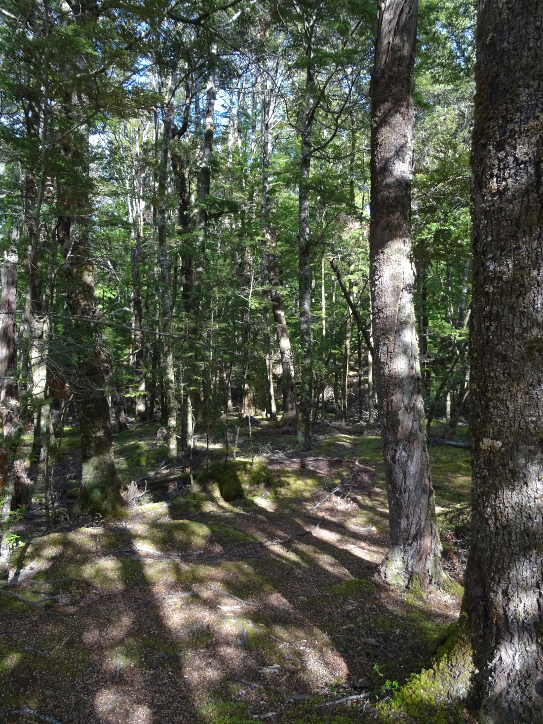
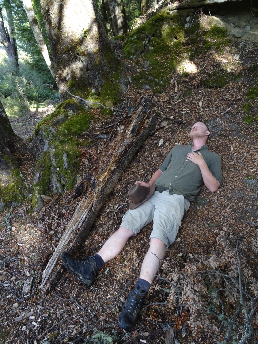
We had a stroll through the forest looking for any little clearing, or cluster of trees we might recall from the films. Close by we passed a sign saying ‘DANGER – dangerous trees!’ Rest assured nothing happened, this is just Ged pretending to be Boromir, slain in the woods.
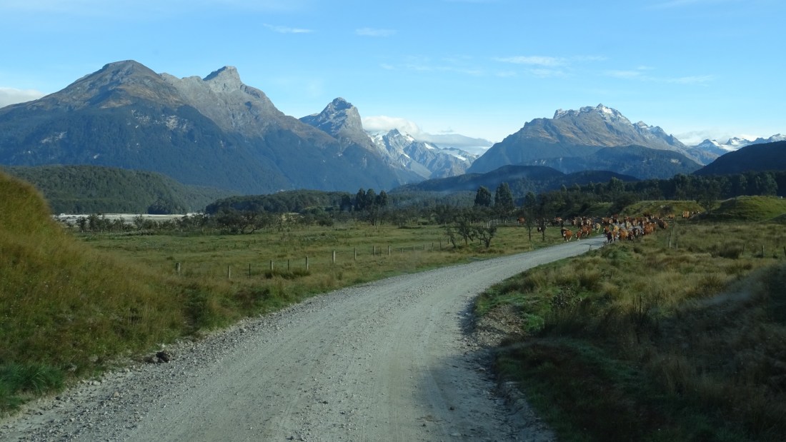
We continued further on into Paradise and ventured to go right to the end of the track when we were suddenly brought to an immediate halt. Cows on the move! And coming right at us. Trotting in fact. Ged put Goldilocks promptly into reverse gear and back we went, steadily, and then a little faster as they gained on us.
Half a mile or so later and we could swing around and make our escape. Phew!
We then drove across a road called Deer Creek towards the popular walking Routeburn Track. It did involve driving over a creek (well rather a dry river bed) but no deer in sight as we drove into the area known as Isengard in the Lord of the Rings films. Cool to be right in the middle of ‘Middle Earth!!
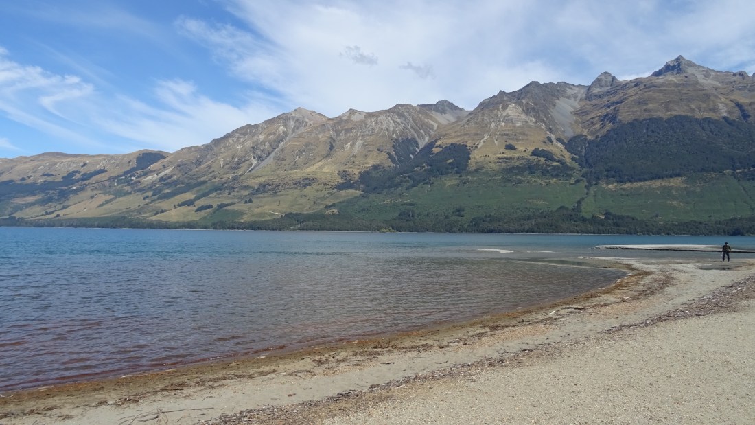
On the way back we stopped in Glenorchy itself for a coffee (Ged) and ice cream (Rach) and to learn a little more about this lakeside village. Glenorchy was officially a railway station! The goods shed stored freight from the wharf, which was transported off he steamers boats by “trolley” on what was the shortest piece of railway in New Zealand.
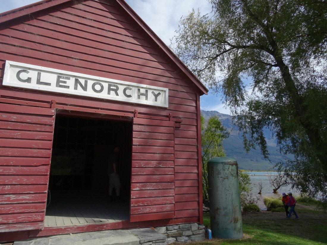
People who lived and farmed here could only travel in and out by steam boat until a road was built in 1962, but that didn’t put off tourists, who began visiting this scenic spot in the 1860s.
Around lunchtime it was time to get on the road again proper and head for our next exciting destination – we were bound for Milford Sound! The journey took around 5hrs of driving, and got us as far as a paid campsite at Cascade Creek, 1hr north of Te Anau and around a 45 min drive left to do the next morning. The drive from Queenstown to the campsite was beautiful, even as we swapped bright blue skies for an increasingly grey and foggy picture as we drove into the forest-lined mountains.
Cascade Creek was busy but had a few vacant areas where fire could be lit (most places we had been so far didn’t allow you to because of the risk of forest fire), so Ged whipped out the disposable BBQ he had bought last week on a whim and got to work. The BBQ was no match for the chicken however, and managed to only partially cook everything!! Tricky to finish off chicken legs on a gas cooker, we ended up stripping the meat off and cooking it in the pan. Butty-material for the next few days!
22 March – Milford Sound
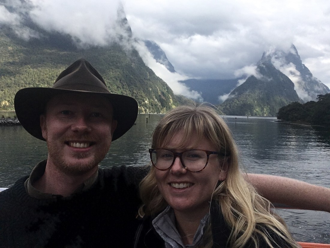
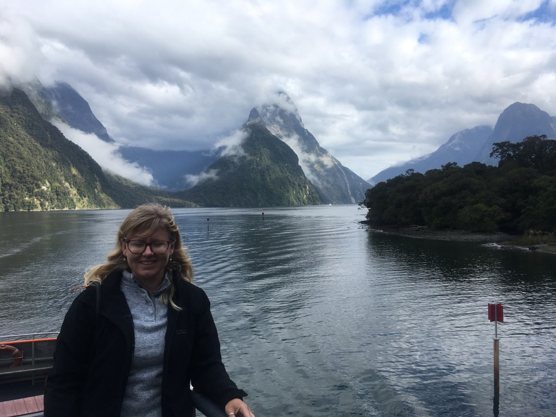
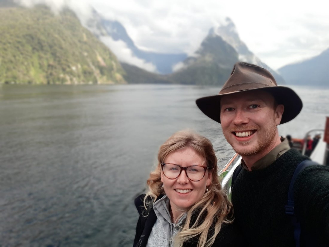
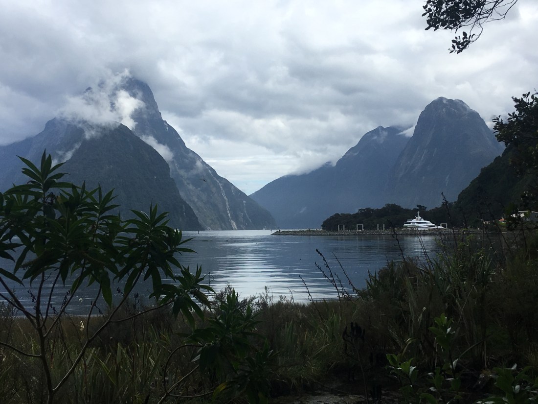
We were up in the dark again this morning in order to finish the drive to Milford Sound in time for our check in time of 8.30am at the harbour. The drive was eerie – low lying mist, struggling light and total quiet (well except for the other cars that gradually joined all heading the same way). We finally reached Milford Sound after lots of winding road and boarded our Go Orange boat. The view at the mouth of the sound as we walked on board was disappointingly foggy (we definitely weren’t going to get a sunny day!) but it certainly added to the atmosphere, as Rach had seen before on her only other fjord experience the year before last in Norway.
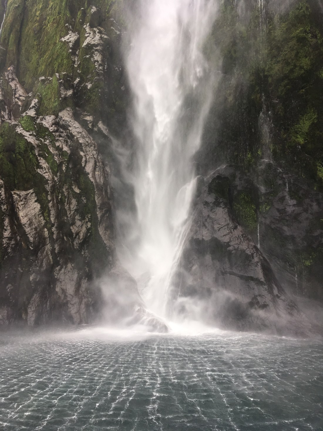
The 2hr sailing was relaxing and allowed us to get up close and personal with the fjord’s sheer cliff faces and waterfalls, including 151m high Stirling Falls which Hugh Jackman jumped off in the film Wolverine, which we got very cosy with!
Sometimes passengers are joined in the sound by dolphins, but today’s special guests were fur seals, playing around the rocks. Rach happily snapped away on her camera while Ged enjoyed the wind in his hair… a fresh and moody autumn morning but a good one no less!
As a side note, you’ll see we keep referring to Milford Sound as a fjord – that’s because it is not actually a sound! A “sound” is the word used to describe a gorge or valley formed by river erosion. Since Milford Sound was actually created by glacier breaks, it isn’t actually a “sound” at all but rather a fjord, but it has kept its name regardless.
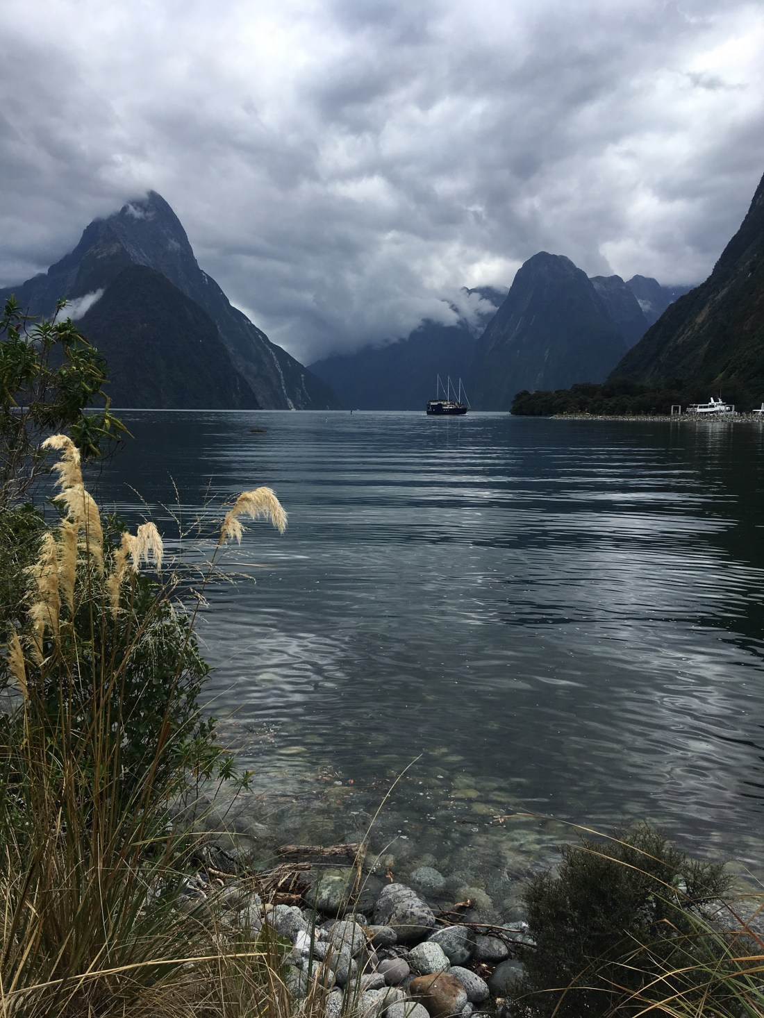
The rain joined in with the mist not long after we disembarked, so we had a quick chicken buttie in the van while we waited for it to go off. After we went for a couple of short walks to admire the now slightly better view of the sound. On our walk up to the higher viewpoint we learned about Donald Sutherland, father of tourism in Milford Sound, and his wife Elizabeth. Sutherland was a Scottish immigrant, who declared in first reaching Milford Sound as a sealer that “If I ever come to anchor it will be here.” Sure enough he did return, in 1877 in an open sailboat with only his dog for company. After 13 years of solitude he married a widow from Dunedin on the East Coast. Her initiative and finance enabled them to buy the land they occupied and start hosting more of the earliest tourists to Milford Sound in the lodgings they built. Sadly in a cruel twist of fate when Donald died, Elizabeth had to live out the last few years of her life in solitude in Milford. Nevertheless, they seemed to live a happy and peaceful life in this picturesque spot.
Their story is a true account of how nature, in its majesty, can spellbind you and make you truly fall in love with a little corner of the earth. It’s a good job Elizabeth loved it as much as he did!
Our walk along the shore front was also lovely (sandflies aside) and we learned a little more about the unique marine ecology of Milford sound. Black and red coral, sea pens and some sponges, all normally found within depths of 100-200 metres, thrive here less than 30 metres below the surface of Milford Sound, fooled by the unusually dark conditions caused by a band of brown freshwater sitting on top of the salt water. Who knew??
Breaking up is hard to do, but unlike Donald we left Milford behind and sauntered back inland though the route we had travelled blindly earlier this morning. Fog well and truly lifted, it was a spectacular journey through the mountainous landscape, and through the Homer Tunnel – an unlined road tunnel through sheer rock at 945m above sea level. Traffic lights control flow through the tunnel so during the 6 minute wait time Rach got out to snap a few pics!
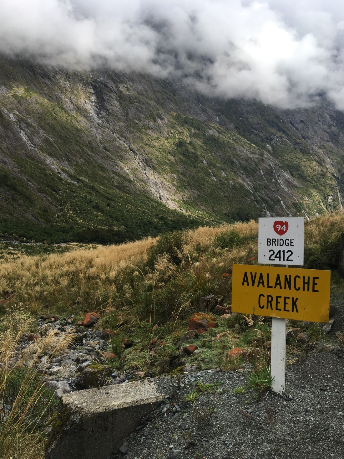
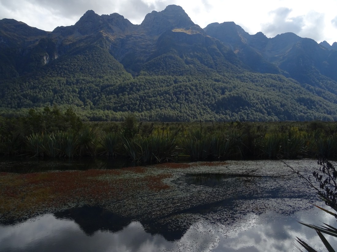
Shortly after we stopped at the Hollyford Valley Lookout, nicknamed ‘Pop’s View’ after Robert Alistair Andrew who died in an avalanche near here in 1983. We made a third and final stop nearer Te Anau at Mirror Lakes just off the roadside – a bit of an improvement from Lake Matheson!
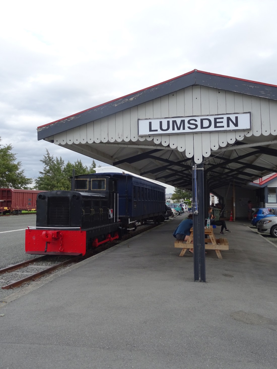
We eventually set up for the night in the cute little town of Lumsden, a sheep farming town where the residents had converted their old steam railway station into an area for self contained camping. It was well equipped with the best toilets we’d had all month(!) and a little sink area for washing up. Thanks Lumsden!
Across the road was a pub with WiFi – time for a tactical move! Buy a pint in the pub and we’d have free WiFi all night in the campervan. Sweet as! Bit of soup for tea and some film downloading later, we went to bed having decided to have a slower day tomorrow. The pace has been a bit punishing!!
23 March – The road to Mount Cook
We enjoyed a rare lie in and a relaxed start to the day before we began our long journey to Aoraki Mt Cook National park. We didn’t have any plans today really other than to enjoy the driving views and maybe do a short walk when we reached our chosen camping spot at Lake Pukaki. En route we pulled over, intrigued, at the signs for ‘Roaring Meg’ (real name Te Wai a Korokio), a beautifully blue stream which feeds two small power stations. Beautiful and practical!
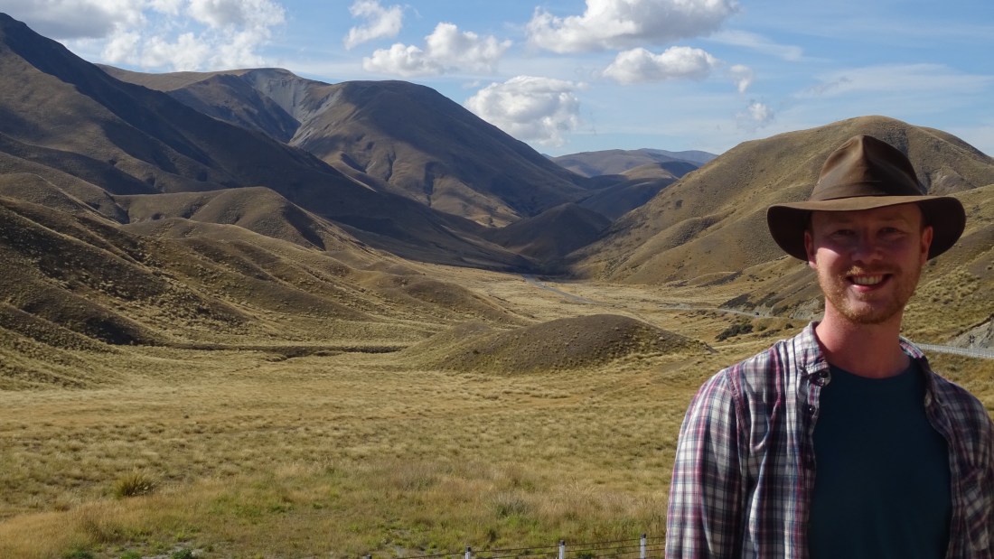
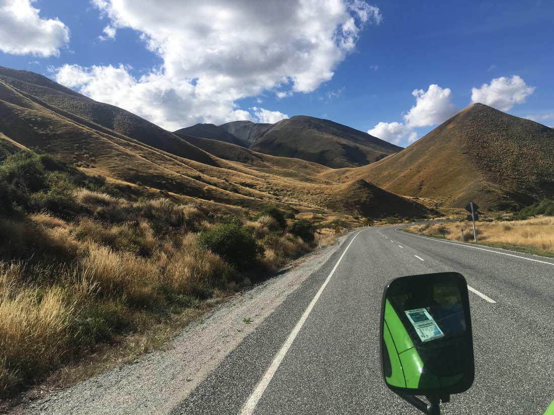
And the name? There are many theories, one of which is that a group of diggers, who were accompanying two women from a dancing saloon, had to carry them across the river. One of the women made such a fuss that they named it after her. In contrast her female companion was perfectly calm so they named the next stream they crossed after her – Gentle Annie. Our day road trip also took us through some other lovely viewpoints, including the dramatic Lindis Pass, a stretch of scenic road passing between tall tussock-covered mountains and the highest road on the South Island. Nice!
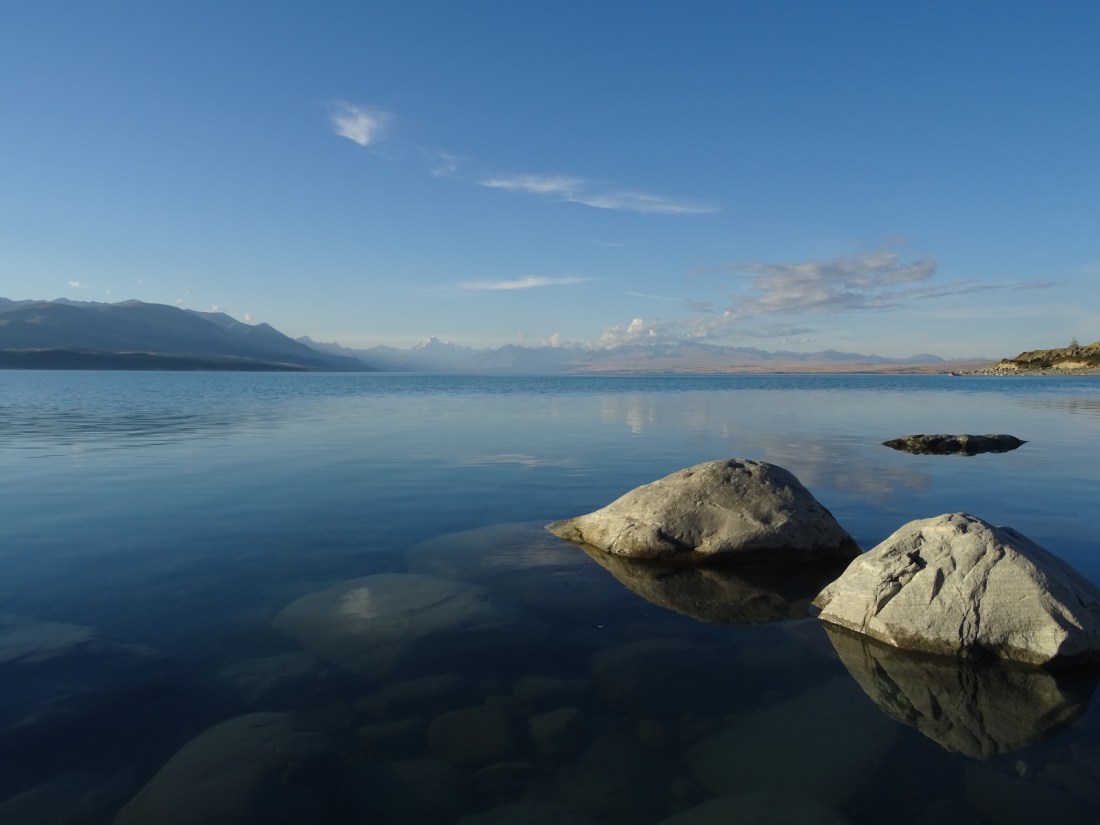
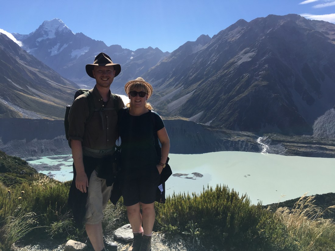
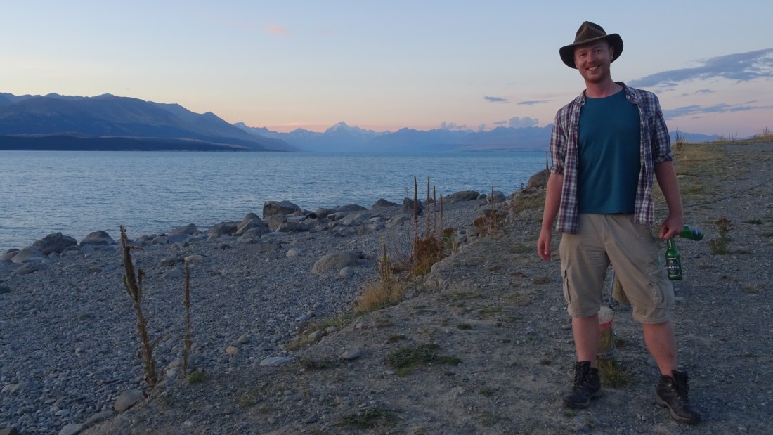
Typically the weather had been beautiful all day so when we finally arrived at Lake Pukaki and we were hit with possibly the finest vista yet, we wanted to drink in every last drop of sunshine. The view across the lake to the rugged and steeply sharp slopes of Mount Cook in the far distance was just sublime. Like our brief time at Lake Wakatipu en route to Glenorchy, we could hardly believe our eyes it was that beautiful. Neither of us had never seen the snow-topped peaks of a mountain so clearly at such a long distance – it almost looked more like a graphic drawing than a real-life mountain.
Views and weather combined, we sacked off the walk and went straight down from our parking spot to the lakeside, climbing over the rocks to get close to the waters edge.
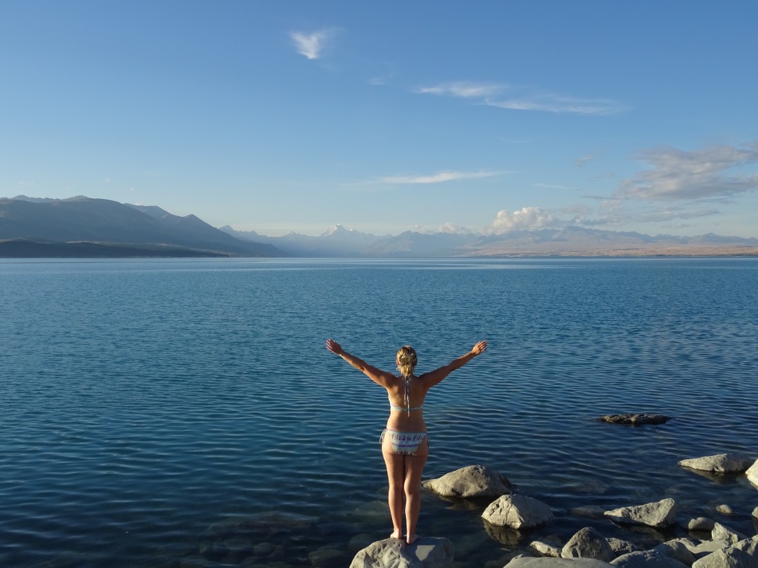
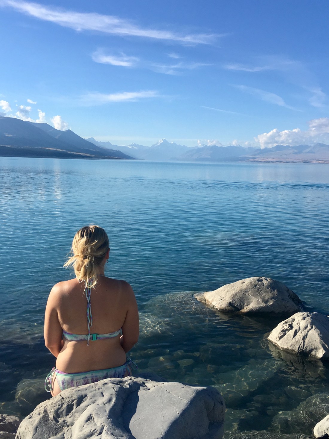
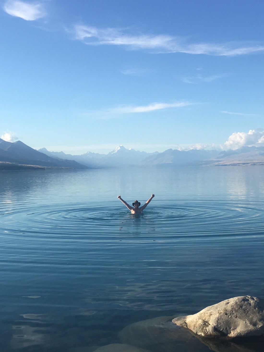
Rach decided there was nothing for it but to get in. She owed it to her wild-swimming fan friend the wonderful Anna B, to get in. She may have even heard her voice in her ear saying ‘just get in woman!’ What better place on earth for a spot of wild swimming? Not wanting to disappoint Anna, she edged in. Wow was it cold. The moment of truth came after she got past her knees, when the water dropped off deeper below the rocks. It was now or never! Face forward she plunged ahead, cold knocking the breath right out of her!! 30 seconds or so though and it was still pretty fresh, but very lovely. The lake was so calm and the view just magic. That was it – Ged had to join the party too!
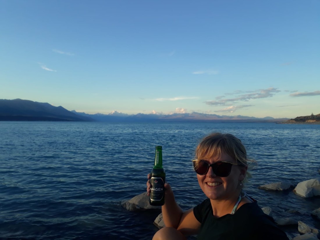
We only regretted not arriving earlier, as soon the sun was setting and the temperature was dropping, so we made our way back up to the van in the fading light. We did however manage to squeeze a little beer in first, perched on the rocks watching the sun go down.
What another amazing end to a day in New Zealand. This place just keeps on getting better and better, if that’s even possible.
24 March – Mueller Hut, Aoraki Mount Cook National Park
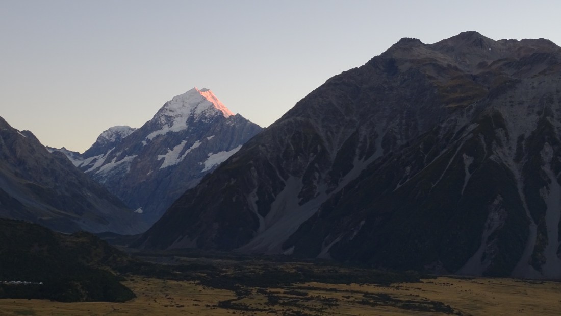
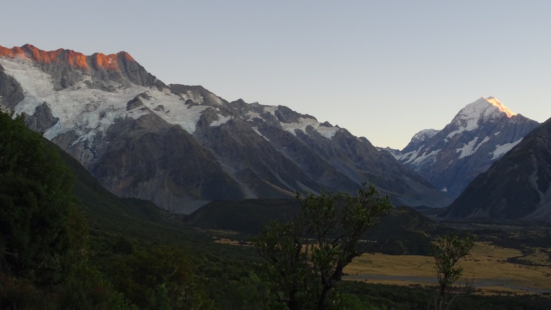
We had checked the weather forecast the day before and we knew that rain was on the horizon during the 3 days we had planned to spend here. Today was meant to be great weather, so we were up before dawn and drove the length of the Pukaki Lake towards Mount Cook in the gradual emerging light.
The objective was to reach the foot of Mount Cook before dawn and take a short half hour climb through some forest up to a viewpoint for sunrise. Parking at the Hermitage Hotel just outside of Mount Cook village, the Glencoe Walk took us to a little bench with a brilliant view of the side of Mount Cook and the surrounding Sealy mountain range, just in time for the sun breaking across the snow capped mountain and reflecting a brilliant pink and orange. What a sight and a fantastic way to be introduced to this spectacular mountain.
Hungry from the climb we devoured a bacon buttie in the van and then went to the visitor centre to get some advice for the next few days’ planning. Here we got a very clear warning about the incoming weather. It wasn’t just going to rain a bit, it was going to throw 250mm of rain down and any chance of doing any walking on the mountains was simply too dangerous. There was nothing for it – we’d have to get our big walk in today!
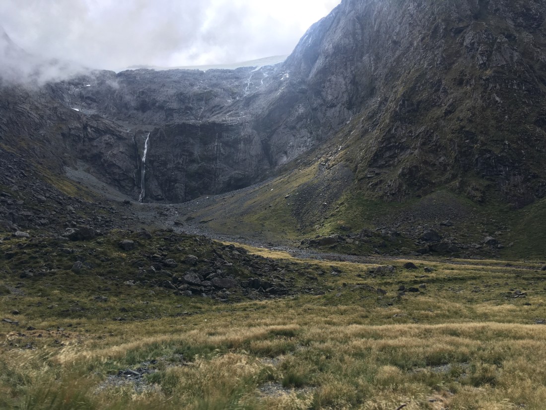
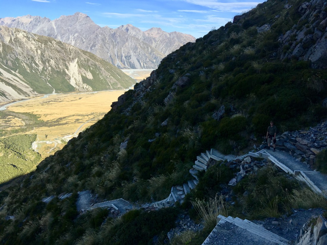
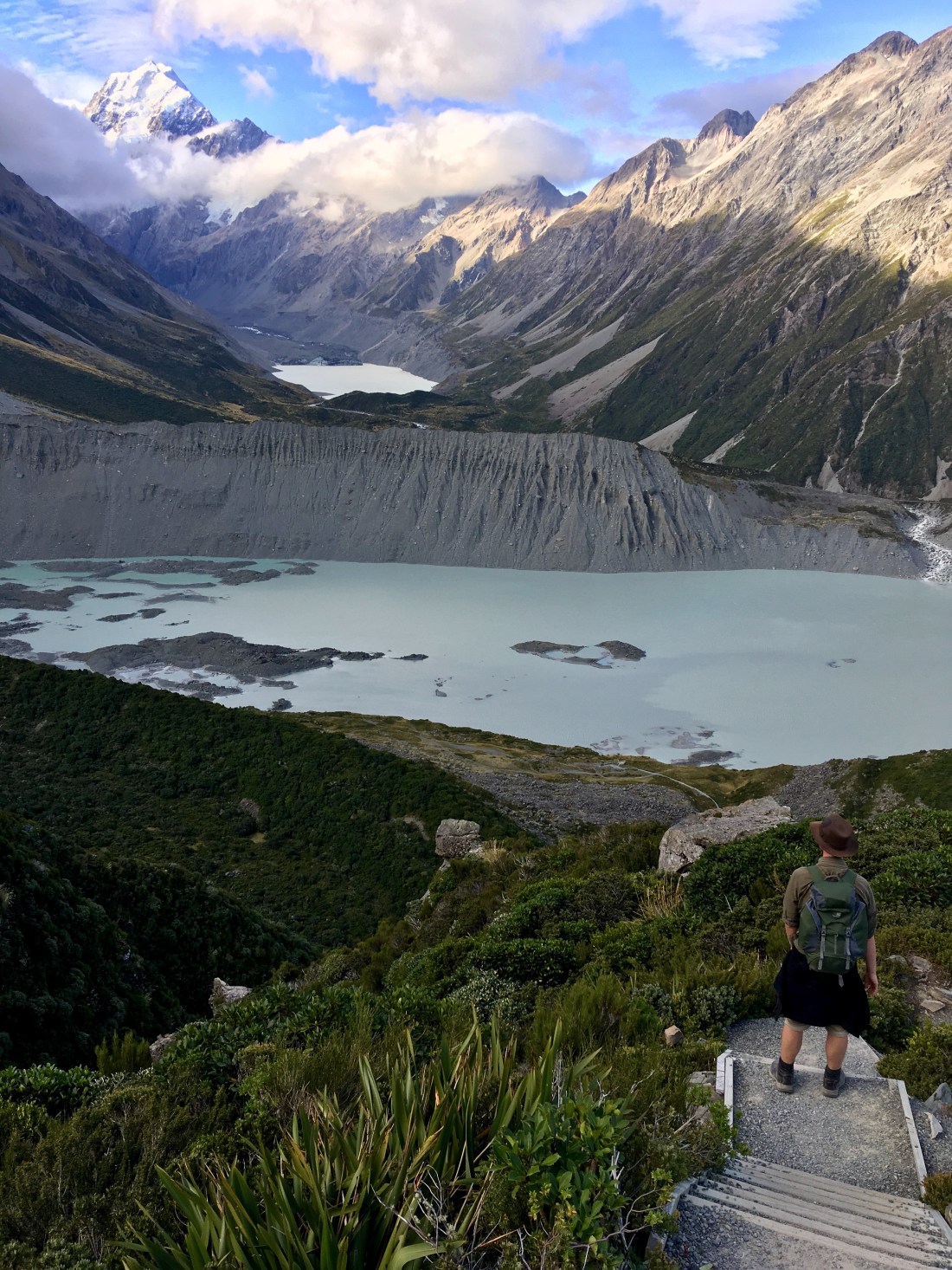
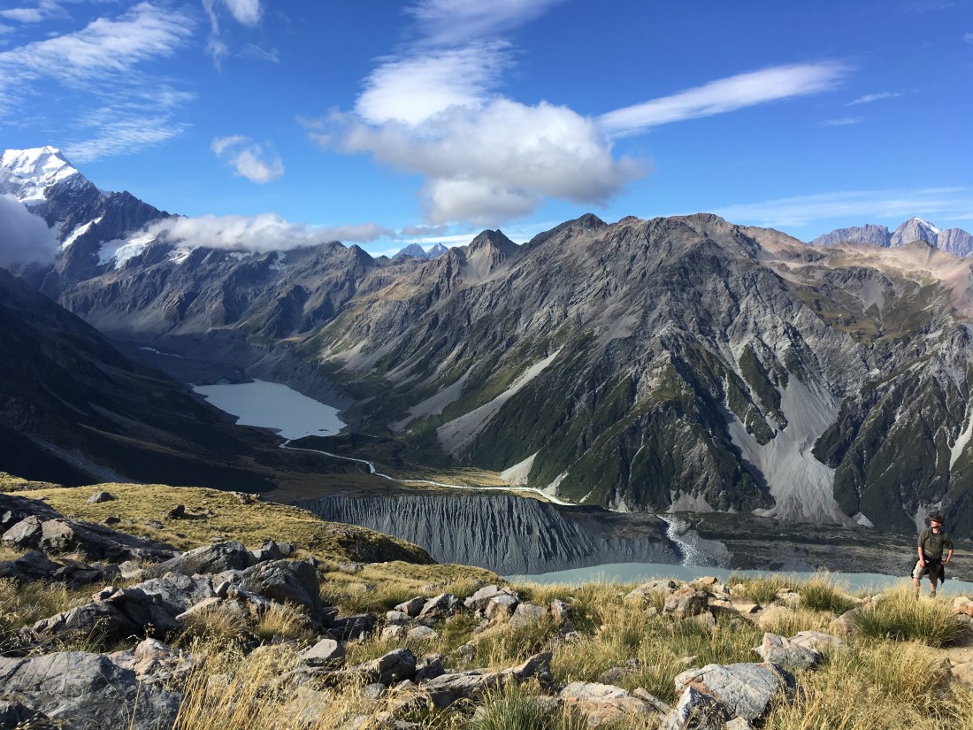
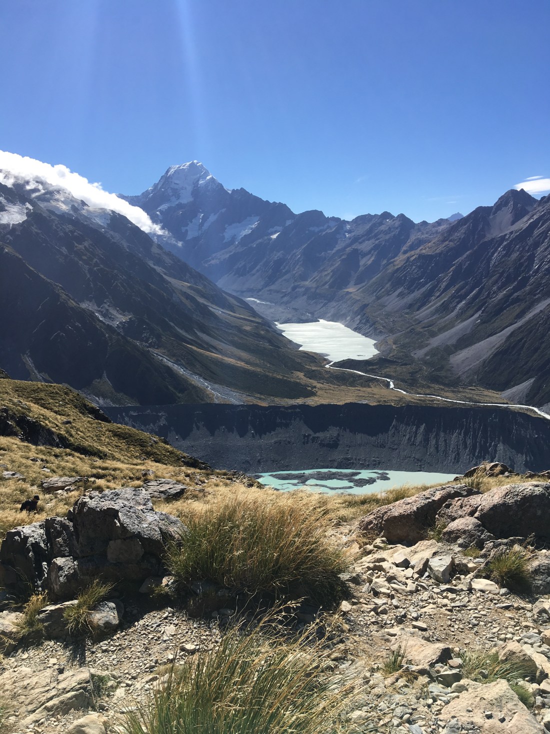
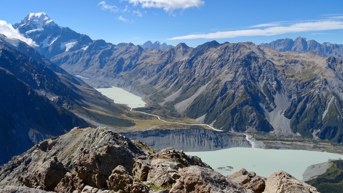
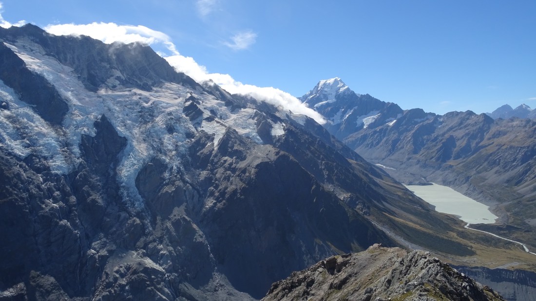
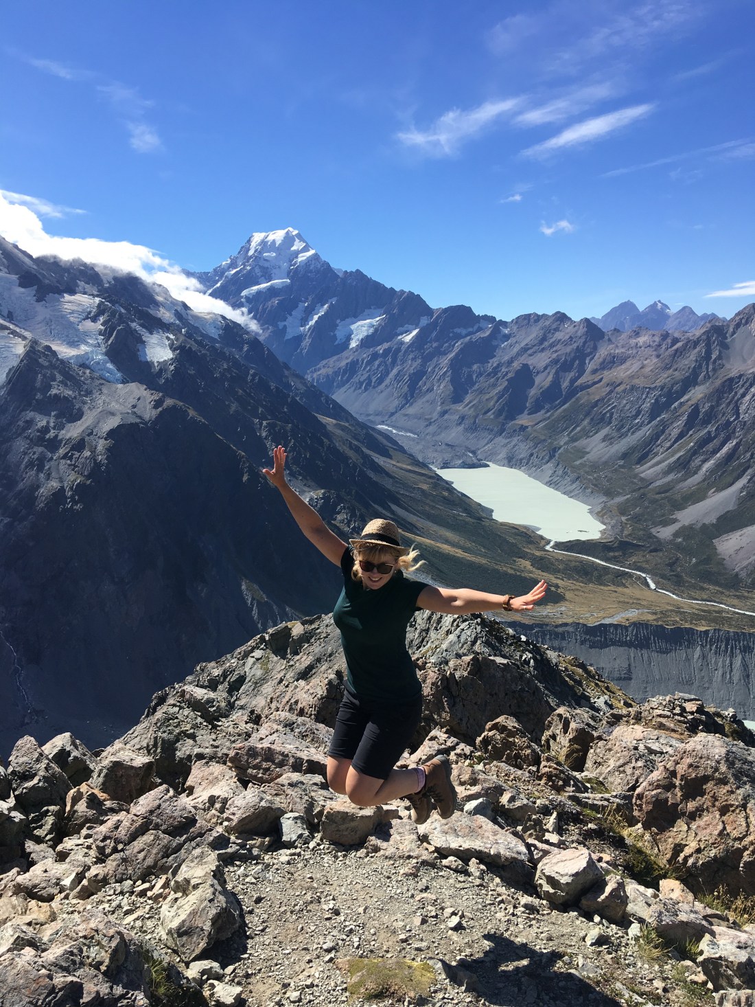
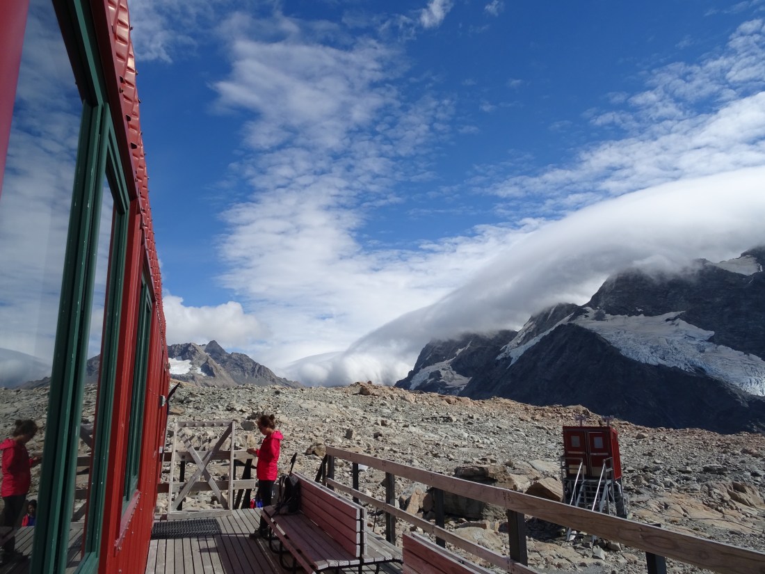
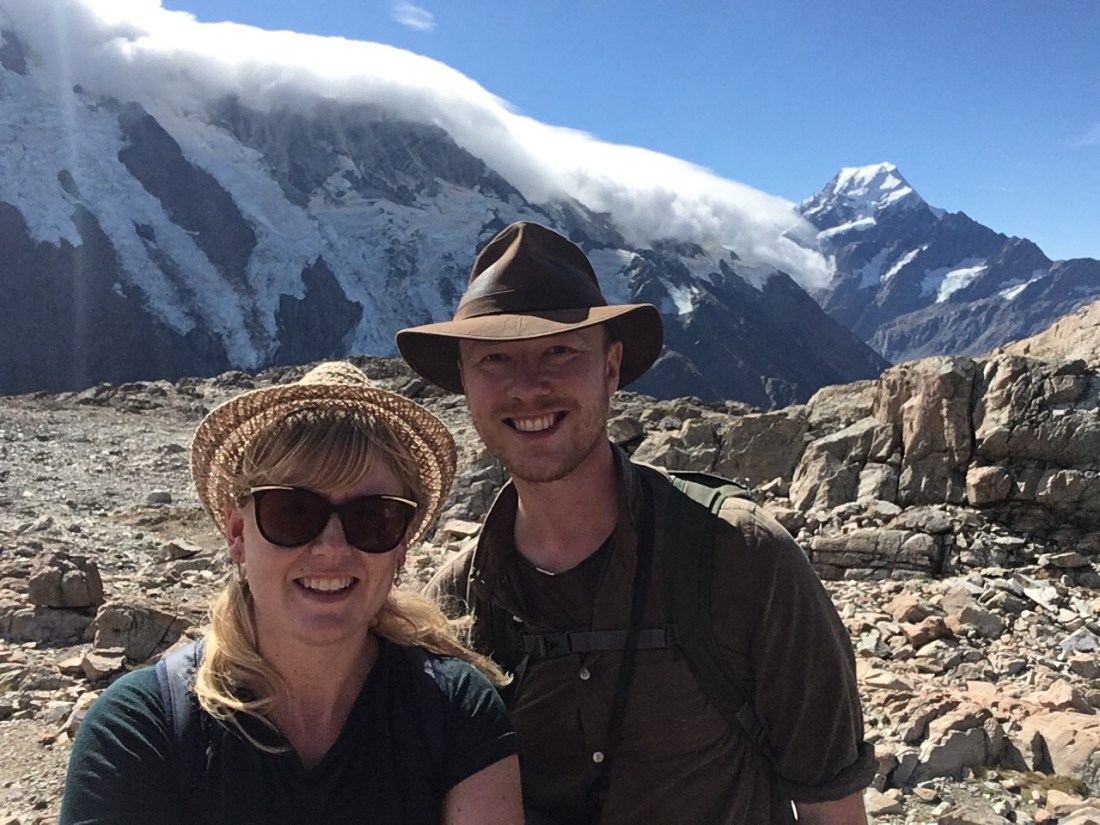
We chose to do the Mueller hut track, a popular but more advanced 11km tramping track up Mount Ollivier to a hut just below the summit (1,800m). It provides relatively close-up and fabulous views of the Mueller glacier, the Mueller Range and Aoraki Mount Cook and the blue waters of the Mueller and Hooker Lakes below.
To the trek: the ascent was TOUGH. It was like Roy’s Peak again but steeper. Quite literally in fact – the ascent was sharply up 1,100m, the first half via steep steps and then eventually scree. By our calculations, using the average height of a step and the approximate distance we climbed, we must have done more than 2,000 steps to get to the halfway point. Yowza. Here’s a shot of the Devil’s Staircase, as we rebranded them – far worse than its namesake on the Tongariro Crossing!
However, with every break we rewarded ourselves with, we got a stunning view behind us.
The scree at first was a welcome break from endless steps, but it soon became a chore in the heat. When would it end? Again though, the view kept our resolve up – we were going to get up this damn mountain!
The closer we got to the glacier the cooler breeze drifted in, and we started to hear some alarming rumbles. Could the storm be coming early? Was this thunder? When we pieced two and two together we realised, rather alarmingly, that this was the sound of the mountain. It’s like it was breathing. The glacier expands and contracts, making a threatening groan as it does. We dreaded to think what an avalanche must sound like stood on this mountain range.
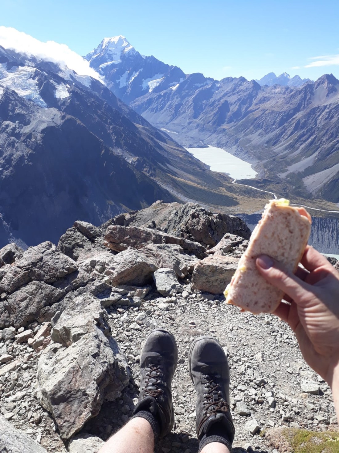
As we crested the top of the mountain we were treated to a fabulous view of the glacier up close. 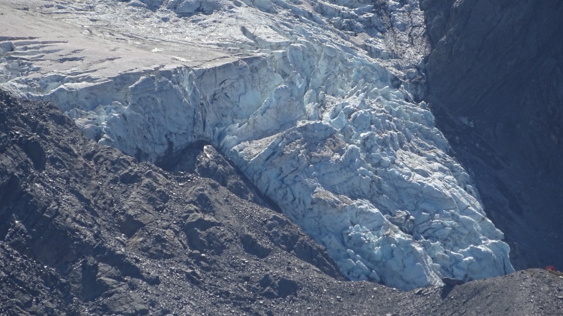
A perfect place for a rest stop. Cue another awe-inducing picnic spot!
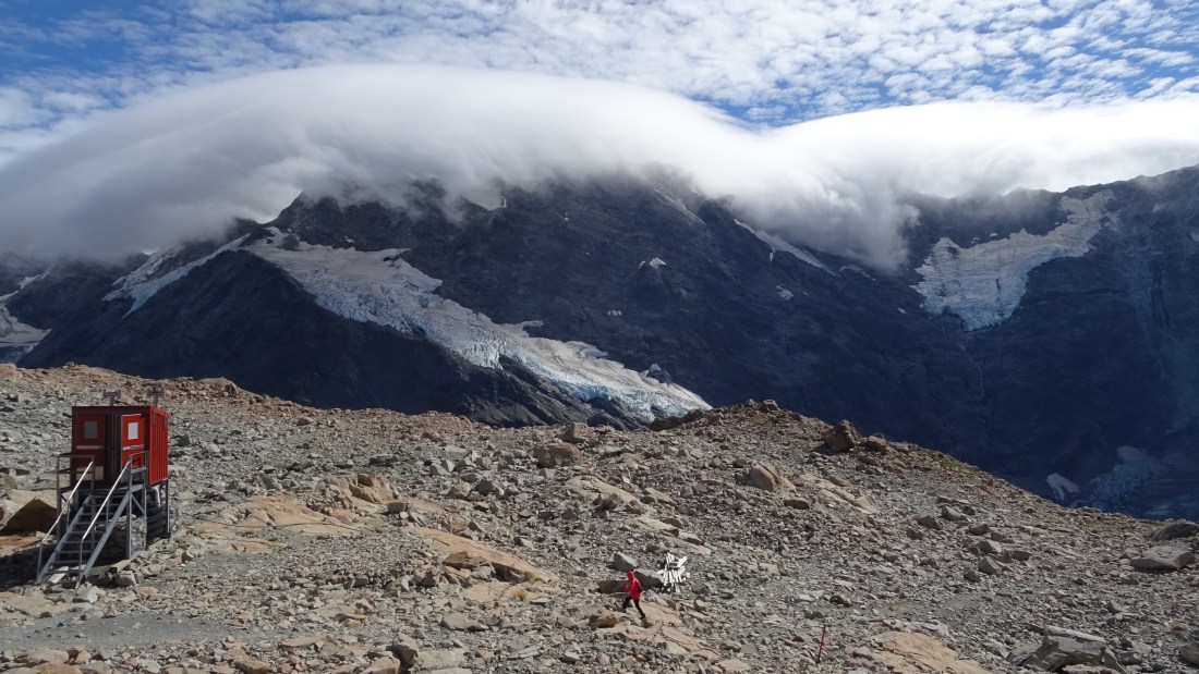
It was another 25 min walk or so away from the views and further into the mountain to reach the hut. The hut was first built in 1914-15 and has undergone several reincarnations since. This fifth version cost $400,000 NZD to build, and took 130 plane deliveries of equipment and materials. It’s comfortable with dorm beds, a wooden cladded communal and dining area and a wardens quarters. Prize for best view from a loo in NZ?
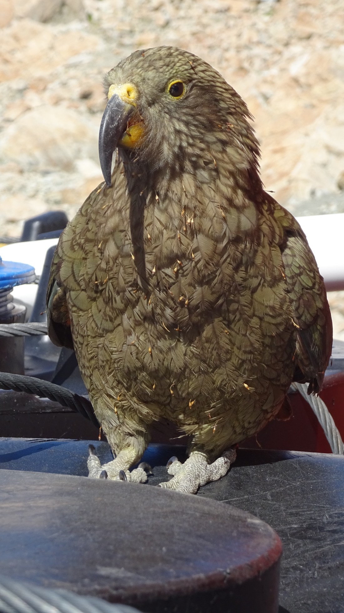
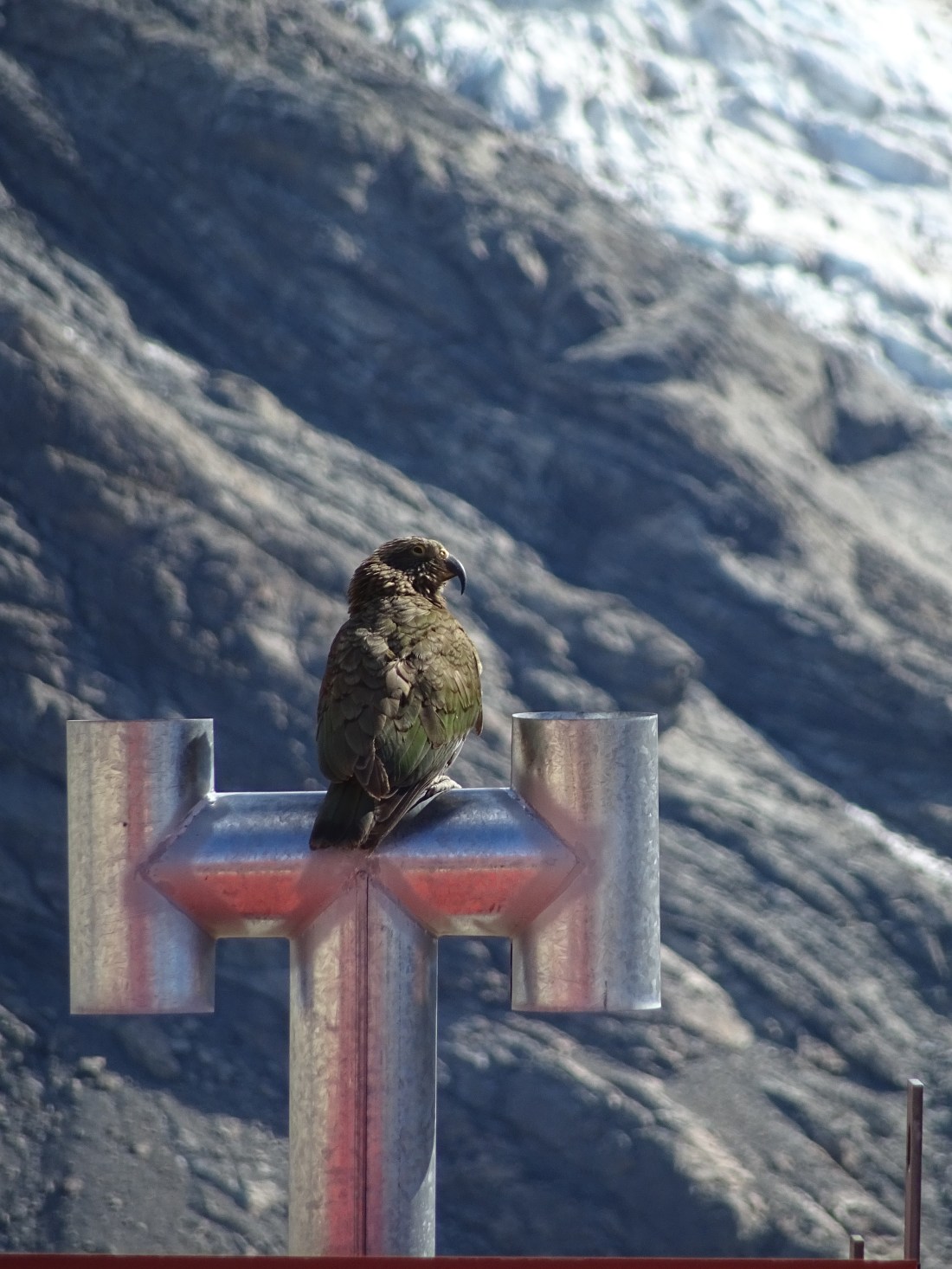
Whilst at the hut we also managed to get up close and personal with a Kea, the only alpine parrot in the world! This one was scavenging for food, and didn’t mind having his photo taken!
We spent a bit of time observing another natural phenomenon up there – Hogsback Clouds, which cascade over mountain summits like waterfalls, and normally herald that a storm is coming.
It was time to start the long climb down, the same way we came. A descent is usually quicker, but not this one! Awkward on the scree, and a real knee killer for Rach, it went on and on and on for hours. The weather held up for us though, and we felt blessed to have the legs and the go, however slow, to have climbed to such an epic place.
After a shattering 8.5 hours we were back at Goldilocks and made the drive back along the lake to the previous night’s campsite as the sun went down.
We picked up a few beers in Twizel to toast our success and then showered and went to bed, tired, but happy ramblers.
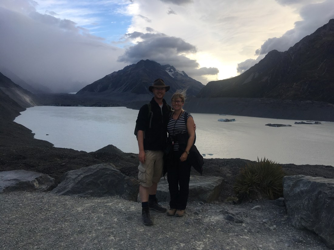
25 March – Another day in Aoraki Mount Cook National Park
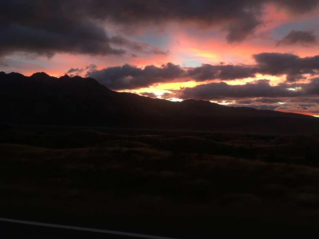
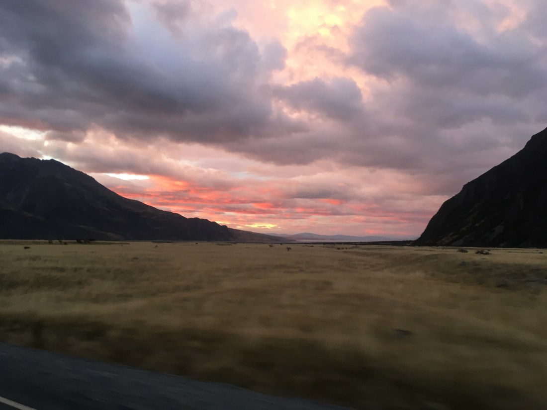
Once again we were up before dawn, but this time the day greeted us with the gentle patter of rain on the windows. We knew the weather was going to turn today so we wanted to get some walking in before the truly bad weather hit. The sun breaking through the clouds as we turned off the Mount Cook Village road towards the Tasman Glacier side was beautifully blood orange, pink and red, but probably a telling sign of what was to come.
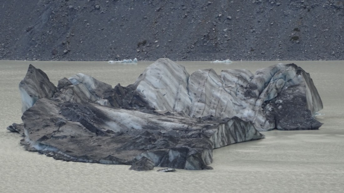
Our first walk was very short towards the shores of Lake Tasman to see the terminus of the Tasman Glacier and the icebergs that are breaking off it. The landscape is utterly humbling (especially the new set of bloody steps we had to climb), and we really got a sense of how tiny we are in the face of the glacier. Tons of ice can break off it in one go and sometimes cause mini tsunamis in the process. The glacier is retreating faster and faster with every year and Tasman lake, which didn’t even exist in the 1960s, is growing larger all the time.
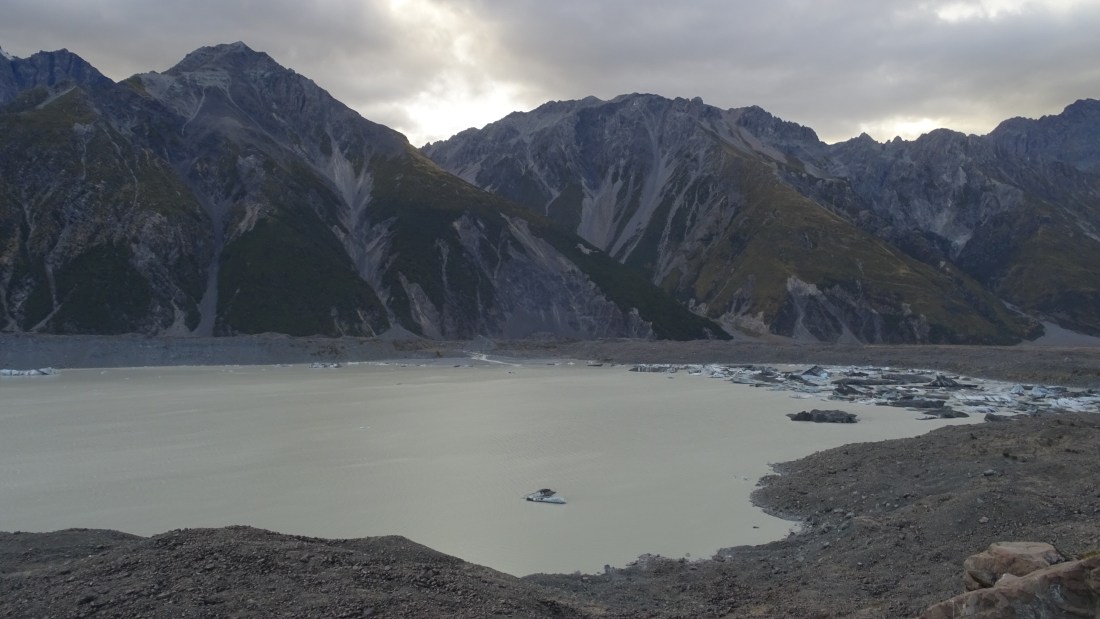
Almost all scientists that study this glacier say the cause of the rapid retreat is global warming and all agree that the damage to the landscape and environment from the melting of the glacier will be catastrophic. Loving the beauty of the place, but sad to know it will soon change forever, we left for another walk and hoped that we can come back before it changes too much.
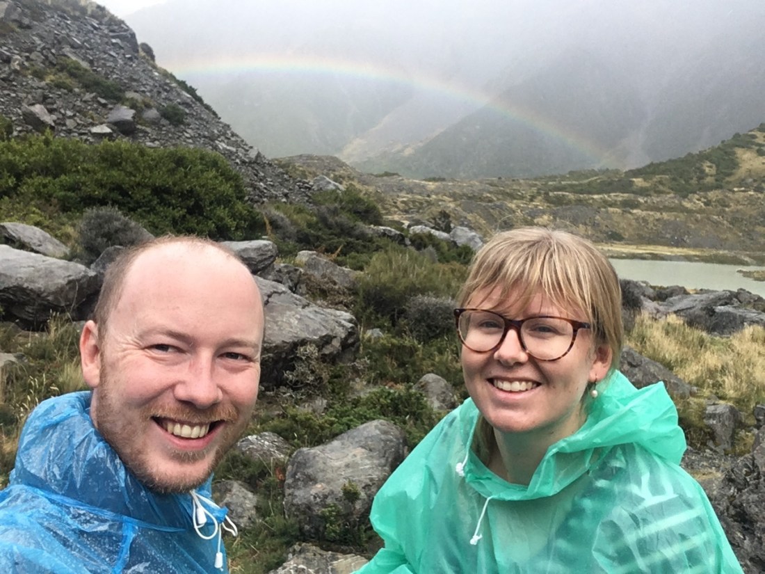
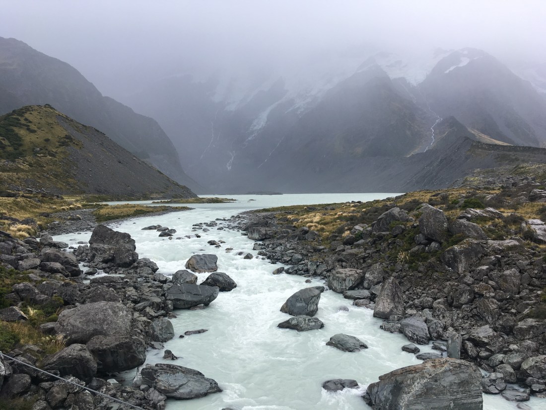
Our next walk was down the Hooker Valley to see a view of Mount Cook and the Hooker Glacier. As we drove to the start of the track the rain started tipping down. We picked up a rather drowned looking hitchhiker who was on his way to the start of the track. We can’t remember the guy’s name but he was from France and glad to be out of the rain for a couple of miles. He set off as soon as we arrived but we decided to don our wet weather garb. Ponchos on! Visibility was poor and we couldn’t even see the outline of Mount Cook. We got about 2/3 down the track, over two of the three rope bridges, before deciding it was pointless carrying on. We couldn’t see anything! We trudged back sodden but were treated to a lovely rainbow for our efforts.
 After some chicken soup in the van the rain really began pouring, so we decided to check out the Mount Cook visitor centre. It turns out it was way bigger than we thought and was more like a free museum really. It had exhibits on the glaciers, the mountains, life in the huts, ecology of the area, Maori legends, and the climbers that have attempted the summits. It was time very well spent learning more about Aoraki Mt Cook particularly. It’s one of the youngest mountain ranges in the world and also the most rapidly rising, as well as being the most steep and unstable landscape in New Zealand. The 1.5km long ridge is as sharp as a knife blade, and has been challenging some of the world’s best professional and amateur mountain climbers for decades. 14 cubic metres of rock broke off suddenly in 1991, lowering the mountain’s height by 10 metres. With such beauty comes such malice.
One very poignant part of the centre is the books detailing the climbers and guides that have lost their lives in the mountains. 230 people have died on the mountain in 120 years. Climbers are still getting caught by sudden avalanches or simply losing their footing. There are equal numbers of success stories however. A monument of Sir Edmund Hillary stands a little up the road; he was the first to climb the South Ridge of Mt Cook back in 1948 (now named the Hillary Ridge). Despite the dangers and without crampons it was three local men in 1894 who first put feet atop Mt Cook. A staggering achievement.
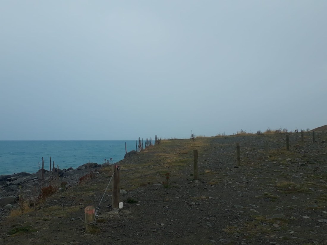
As the rain pummelled the landscape we retreated out of the national park down the lake to Twizel and took the opportunity to get some clothes washed, get our last food shop, and get some well earned chips. There’s not much going in Twizel so once loaded up we headed back to our campsite by the lake for a third night. The rain got heavier and the wind picked up as the storm rolled in. We battened down the hatches and watched a film as Goldilocks shook in the wind. We were glad we had a van and not a tent that night! What a difference a day makes! Here is the view taken from the campsite shore last night, and then at the same spot this evening before the storm came. It really is mad how quickly the weather can change in New Zealand.
Our mood got as gloomy as the weather as we realised our New Zealand hiking days were probably over.
26 March – Total washout
We woke to find that the storm was much worse than predicted in the national park – 230km per hour winds and half a metre of rainfall in a single day. We sincerely hoped no-one attempted to go anywhere near Mt Cook yesterday afternoon. Today promised to be just as drab (although not as windy) and so after a bit of a lie in and our favourite beans on toast we drove to Lake Tekapo to see what we could see. Turns out not very much. The relentless rain restricted our views of the lake and made it pointless staying in the area overnight. Lake Tekapo is in a dark sky reserve and the absence of light pollution is meant to give visitors the most astonishing astronomical experience, well if there are no clouds. No milky way for us. We waited in a cafe for a couple of hours to see if the weather would shift, but no such luck. After catching up on some trip admin we decided to make the long drive to Christchurch. The weather was meant to be just as bad the next day so at least we could hide in a museum in the city. We drove through the fairly dreary and flat Canterbury Plains as we got closer to our final stop in New Zealand. The flatness of land was strange to drive through after being amongst the mountains for so many days. It was as if someone had stolen the peaks under the cover of the clouds. The small towns we passed through we very quaint, with places like Geraldine having saloons, bakeries, general stores, and adverts for church dances and manure by the kilo. The miles soon flew by and before long we were looking for a spot to camp for the night. We found a plesant little place to camp by a river and cooked our last proper meal of mash, pork chops, and an onion/garlic/tomato sauce (Ged’s creation!) We needed to use up the last of what we had, and sadly this included the last of the beer stash. Ged’s final beer was his favourite made from all NZ ingredients and went down a treat, especially as it turned out to be about 7% alcohol….. we thought about our last full day in NZ and were sad that it would soon be over. We weren’t ready to say goodbye to Goldilocks yet!
27 March – Christchurch
Our last full day in New Zealand was spent exploring Christchurch city. Situated on the East coast of the South Island, Christchurch is New Zealand’s oldest and third biggest city. Known as the garden city, parks and gardens account for a huge amount of the city’s space and the downtown area is very cosmopolitan with a myriad of coffee shops, art shops, bars, eateries, and boutiques. The city was dramatically and tragically changed in 2011 when a series of earthquakes hit the city. Several buildings were destroyed and the city is very much still rebuilding.
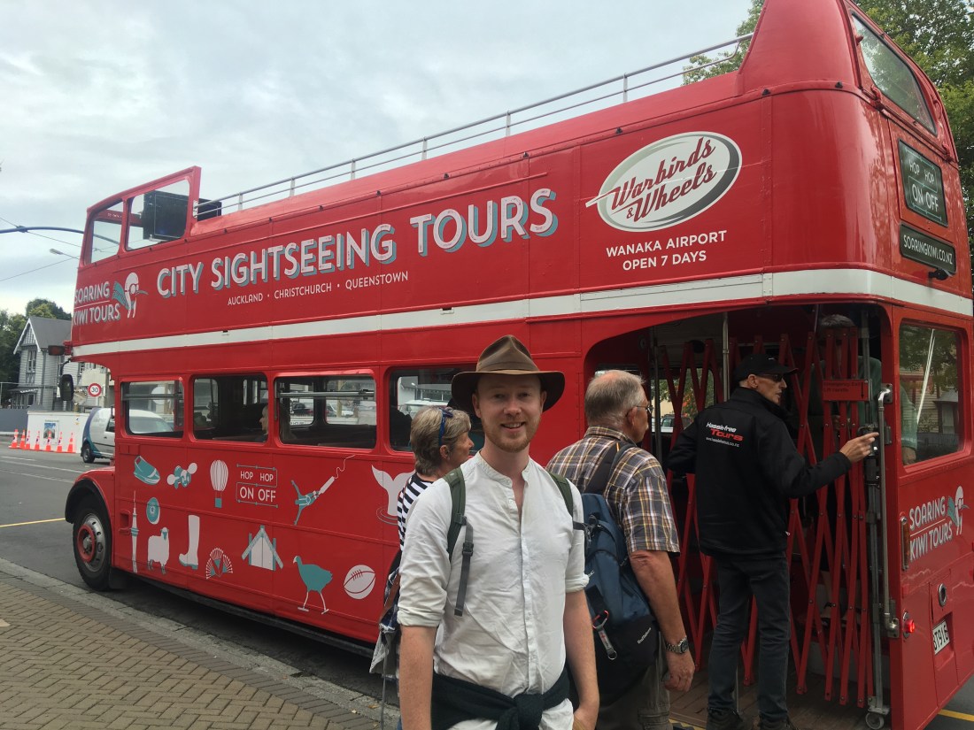
We parked near to Hagley Park and made the short walk to the Canterbury Museum and the Botanical gardens. Rach had spotted a discount code for the open top bus tour of the city and this was the main pick up point for it. Our discounted live tour of just over an hour for £4.50 each was probably worth it, but the full price of about £17 each was definitely not!! The city is quite small so it isn’t a big tour but there was lots of information about the founding of the city, the old boys schools and art colleges, the devastating earthquake, the rebuilding of Christchurch, and the top things to visit about town. It was a good way to whizz around and get a feel for the place.
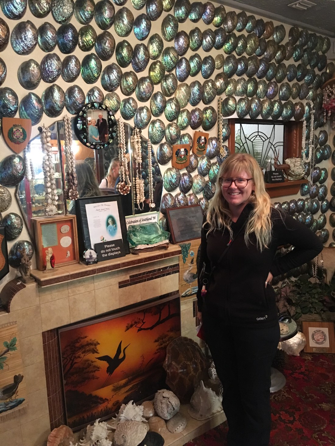
We ended the tour outside the museum and popped in for a couple of hours. The museum is free and truly one of the more quirky museums we’ve been in. There are exhibitions about pre European culture, the first European settlers, the development of Christchurch, current New Zealand culture, polar exploration, and dinosaurs. This would all make for an excellent museum in its own right, but for us the “pearl” of the exhibitions was the recreation of Fred & Myrtle Flutey’s house. Fred loved to collect and polish Paua shells and following an argument with his wife about leaving them on the floor he nailed one to the living room wall. Before long their walls were completely covered in hundreds, if not thousands, of these polished shells. The house became known as the embodiment of Kiwi kitsch and over the years they welcomed over a million people from around the world to their home. Following their deaths their grandson contacted the museum to see if they would like to look after the collection. What happened was that they secured funding to recreate the bungalow in the museum and painstakingly place every shell in the same position. A truly bizzare, heartening, and uplifting exhibition, the shell house is a must visit in Christchurch. Especially for free!!!
Ged wanted to stay in the museum longer (bloody typical) but Rach wanted to get out and see more of the city with her camera. One of the most interesting things to shoot was the cathedral that partially collapsed during the earthquakes of 2011. This once beautiful (and arguably still beautiful) building suffered massive damage and requires so much work to put it right.
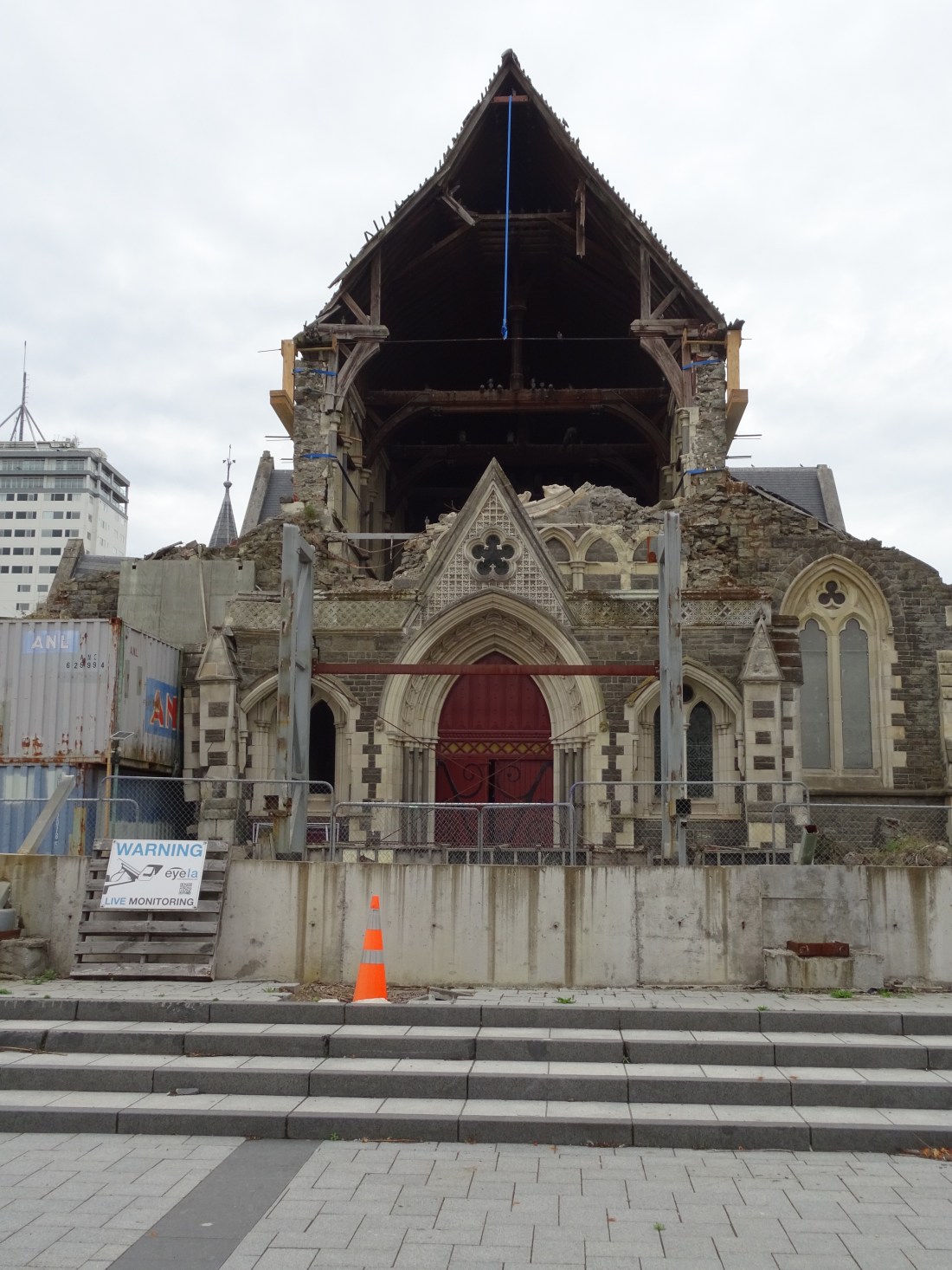
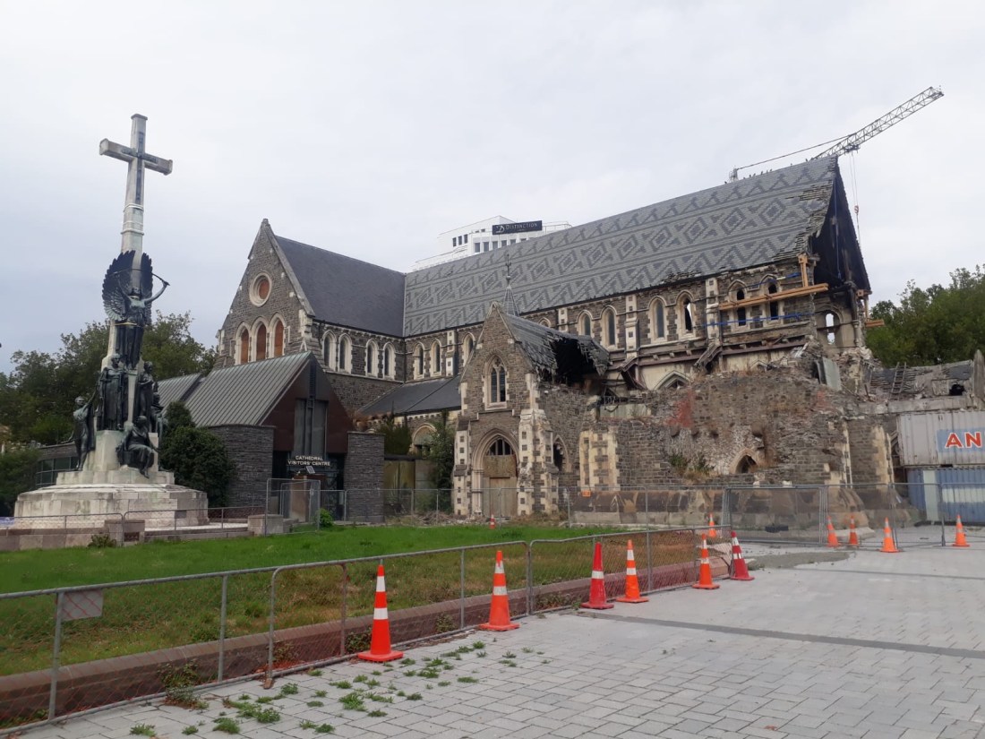
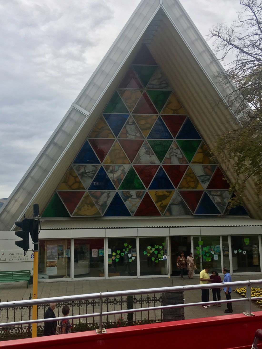
There is no idea how long this work will take, but for now a “cardboard” cathedral stands a few blocks away to host local worshippers. This building really shows how Christchurch is bouncing back and rebuilding in ingenius ways.
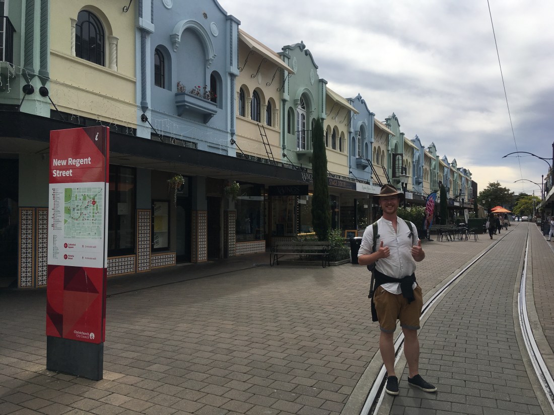
Ged joined Rach and we then headed down New Regent Street which has very different architecture to the rest of the city. The street is lined with bars, cafes, and tourist shops making it a cool place to hang out.
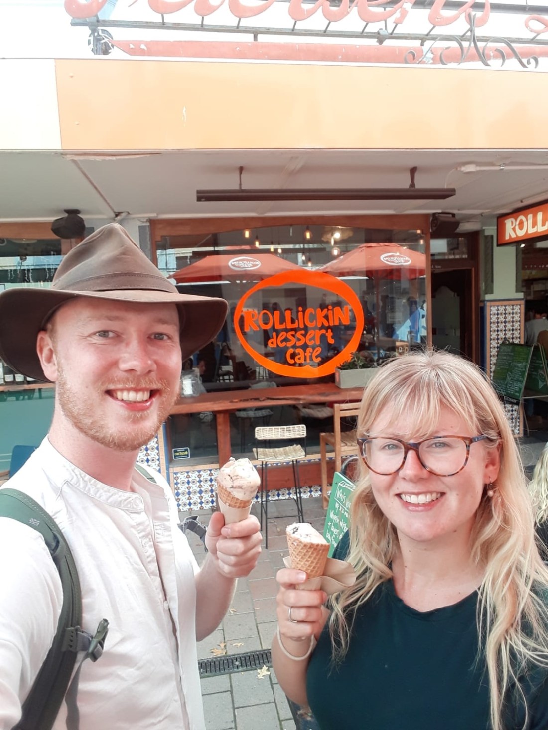
Ged broke with tradition and got an ice cream, well two actually (go big or go home!). One scoop with Jameson’s whiskey and another with carrot cake. Terrible choices for Rach but perfect for Ged. Ged was just waiting for the right flavours!
The carrot cake ice cream was called big love and all of the profits from it were to be donated to helping the familes of the murdered and the survivors of the terrible mass shooting in a Mosque in Christchurch a couple of weeks earlier. As we walked around Christchurch we got a real feeling that people from every part of the community were in shock and mourning. The messages on the sea of flowers laid in front of the botanical gardens were all messages of solidarity – no matter what race or creed we are all New Zealanders, we are all one people, we are feel this pain together.
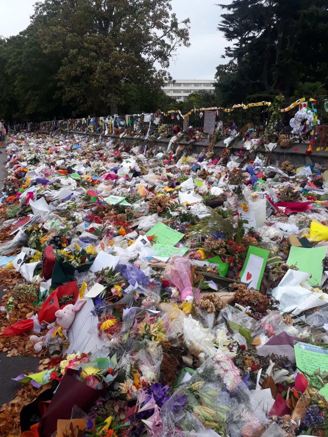
We understood very clearly that no one held the abhorent views of the gunman and if anything this will bring local New Zealanders together rather than cause division. We truly hope it does.
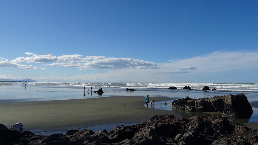
Later in the afternoon we felt like we weren’t quite done with New Zealand’s beaches and should take our last opportunity to look at the sea before we left NZ. We drove to nearby Sumner Beach to find it nearly deserted.
A little too breezy to sunbathe, we found a nearby bar to have what would turn out to be our last beer in New Zealand (cue violins playing sad music over the sound of tears and sniffing).
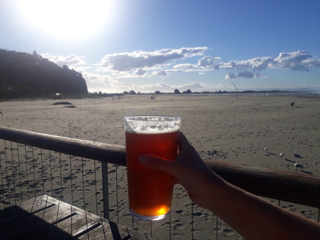
Drinking a good beer with the beautiful beach view made it hard to think about leaving. Tomorrow would be a mammoth day and we weren’t ready to go. We had blitzed through New Zealand, seeing so much, but no doubt missing even more. We think we will be back and talked about where we would venture next time as we headed back to our campsite thirty minutes away. Neither of us doubted there wouldn’t be a next time.
28 March – goodbye NZ!
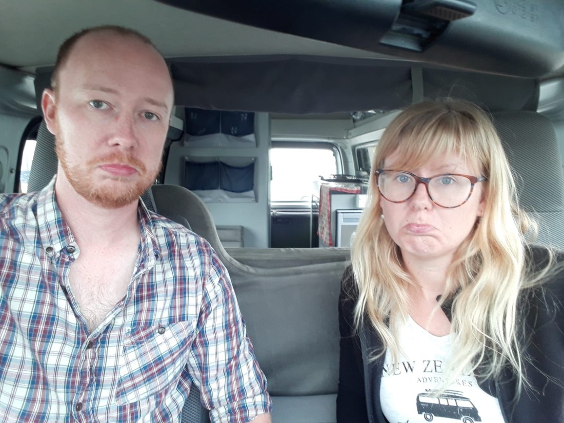
Our last morning in New Zealand started with packing up and and giving Goldilocks a good clean. When the van was spick and span we felt very sad indeed. The morose mood continued as we drove to the rental office near the airport. We’d had so many adventures with the van over nearly 3000 miles. We weren’t ready to go! But of course we had to. One last pat of the van and we left to wait for the shuttle to the airport. 27 hours of travelling and four flights awaited us before the start of our South Asian adventures.
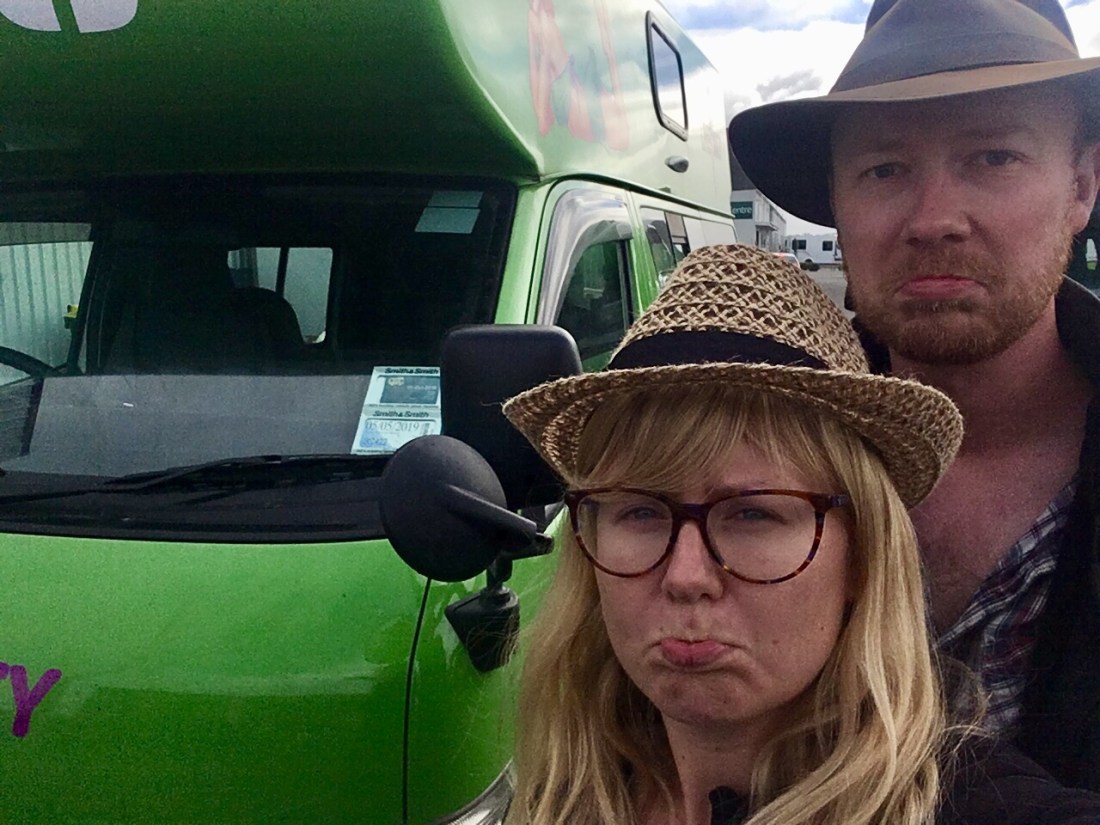
Goodbye Goldilocks and New Zealand – what an adventure we’ve had together. We’d like to think this is not bye forever, just a see you later!
